Where is the entrance to Yosemite National Park?
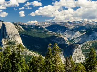
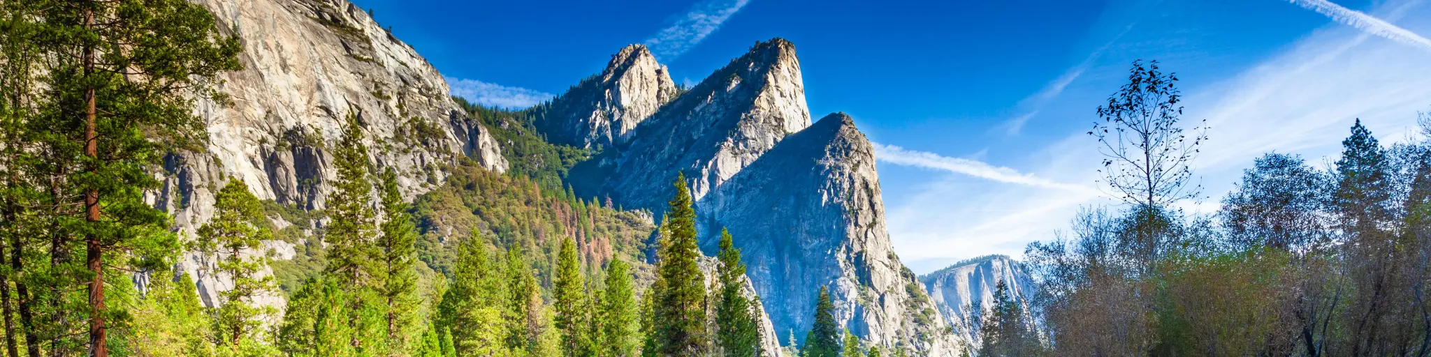
Located in Central California, Yosemite National Park is best known for its giant sequoias, granite cliffs, stunning waterfalls, and iconic sites such as El Capitan and Half Dome. The national park is reachable from San Francisco, Sacramento and Los Angeles from the Pacific Coast and Las Vegas from the east.
Yosemite National Park has 5 entrances so, depending on your starting point, you can see which are most accessible to begin your visit. These are Arch Rock Entrance, Big Oak Flat Entrance, South Entrance, Tioga Pass Entrance, and Hetch Hetchy Entrance.
Read on to learn more about each of these entrances, how to reach them, what to see nearby, their opening times and seasonality information, as well as our travel tips that will get you to Yosemite National Park via these entrances in the most convenient way.
| Entrance | Via | Things to see nearby |
|---|---|---|
| Arch Rock Entance | CA-140 From Fresno direction | Arch Rock, Bridalveil Fall View, Cascade Creek, Pohono Bridge, Tunnel View, El Capitan |
| Big Oak Flat Entrance | CA-120 From San Francisco direction | Carlon Falls, Merced Grove, Tuolumne Grove, Tamarack Creek, Cascade Creek Overlook, Crane Flat Lookout |
| South Entrance | CA-41 From Fresno direction | Clovis Botanical Garden, Yosemite Mountain Sugar Pine Railroad, Mariposa Grove, Yosemite Lakes |
| Tioga Pass Entrance | CA-120 From Lee Vining direction | Lee Vining, Mount Dana, Lembert Dome, Tuolumne Meadows, Tioga Road, Ellery Lake |
| Hetch Hetchy Entrance | CA-120 From San Francisco direction | Poopenaut Valley, Evergreen Lodge, O'Shaughnessy Dam, Wapama Falls, Hetch Hetchy Reservoir, Kolana Rock |
Please refer to the map below for the locations of each of these entrances:
1. Arch Rock Entrance
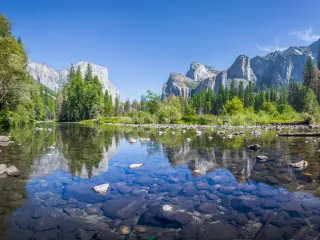
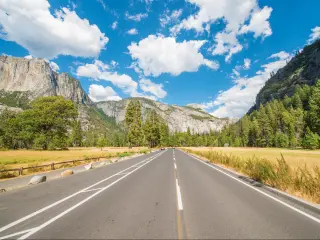
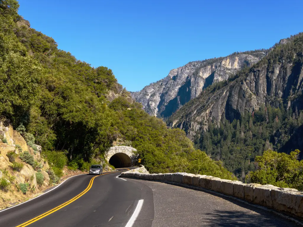
What this entrance is good for: Arch Rock Entrance, also known as El Portal Road Entrance, is one of the most direct routes into Yosemite Valley is you are traveling from the west. It follows the Merced River, offering beautiful river views as one approaches the valley.
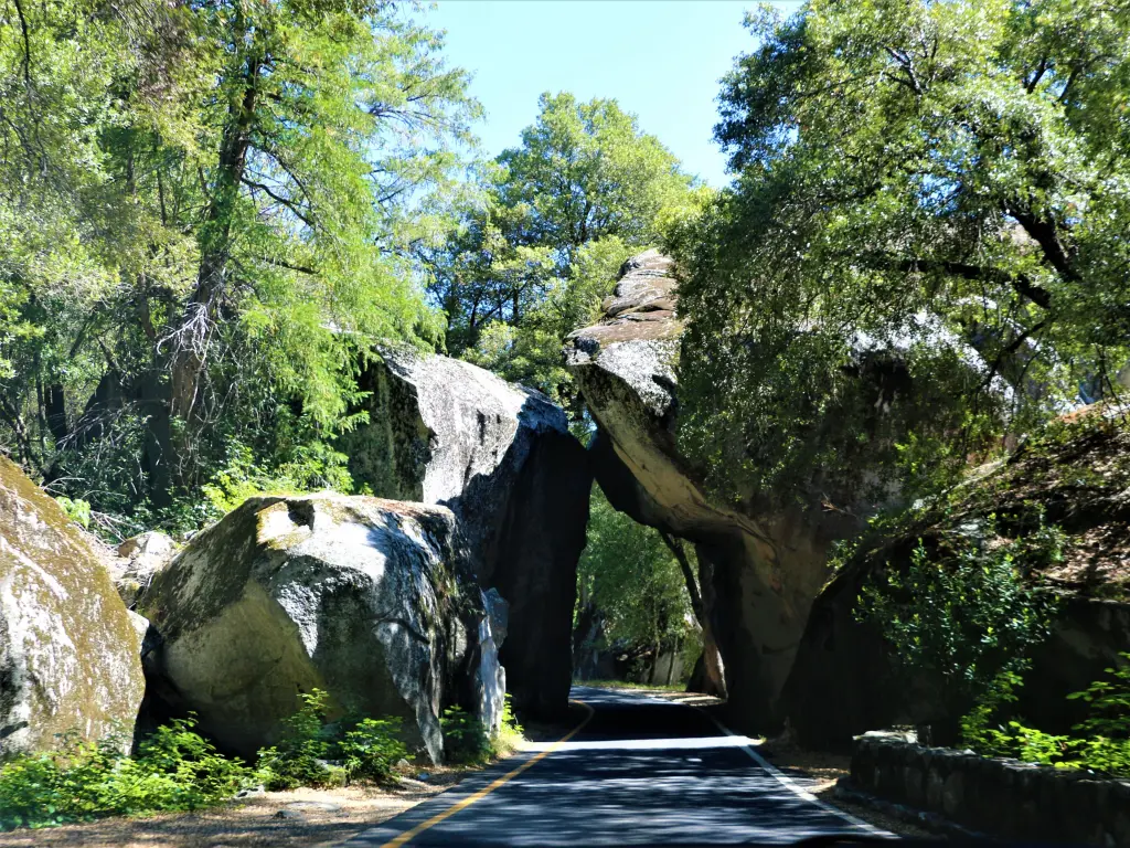
Two huge boulders, situated on either side of the inbound road, form an archway for visitors to pass through – hence the name. It offers a unique and picturesque gateway for visitors entering the park.
The combination of the Merced River, forested surroundings, and rock arch makes for a scenic introduction to Yosemite for those driving in via this route.
Nearby Merced River also offers opportunities for swimming, fishing and even rafting during certain times of the year.
How to get there: Located on CA-140, Arch Rock Entrance approaches the national park from the west and is the most direct route from Merced and other Central Valley locations. It leads directly into Yosemite Valley.
Closest town/city: The closest small town to the Yosemite is El Portal. If you stop off in El Portal, you can refuel and there is a market, camping grounds, and picnic area nearby.
Mariposa and Merced are also close by and offer amenities during a stop off ahead of a Yosemite visit, including the opportunity to top up on gas and supplies.
About this entrance: The name "Arch Rock" comes from a small, natural granite arch formation located nearby, where, over time, large boulders eroded to form an arch. It provides a unique gateway and photo opportunity for visitors entering through this route.
It's not seen as grand as other entry points, however, it is long-standing and reveals the wonders of Yosemite Valley beyond.
Opening times and seasonality: With a lower elevation, the Arch Rock Entrance typically remains open throughout the year, even when other entrances may close - Arch Rock Entrance provides consistent year-round access and scenic drive as long as the conditions allow.
However, remember that Arch Rock can be affected by temporary closures or the need for chains due to snow, so it is important to carry tire chains in winter months.
Yosemite National Park is open 24 hours per day, 365 days per year, with this entrance also likely to be the same as long as the conditions permit.
Things you need to know: From spring through fall, Yosemite National Park can be particularly congested, so there will likely be delays in afternoons and weekends.
It is best to arrive early in the morning or in the late afternoon to find parking and avoid traffic delays.
The facilities at Arch Rock Entrance are fairly basic, so for visitor centers, restrooms, food, gas, and lodging, continue into the park or use facilities at nearby El Portal.
Parts of El Portal Road are narrow and can be winding, especially as you approach the entrance, so some might prefer the wider roads of other entrances.
The entrance fees are the same at each of the 5 entry points to visit Yosemite National Park and they are valid for 7 days. Private vehicle tickets cost $35, motorcycle tickets cost $30 and individual tickets (walk-in, bicycle, horse, in a bus) are $20 each, aged 16 or older. These prices are calculated at the time of writing.
The Best Things to See Near Arch Rock Entrance
- Fresno Flats Historical Village and Park - A cultural attraction near Yosemite, dedicated to preserving and showcasing the 19th-century history of the Sierra Nevada foothills and the daily lives of its pioneers.
- Merced, California - A city in the San Joaquin Valley, located near Yosemite National Park, serving as a primary gateway to the park and known for its rich agricultural history.
- Don Pedro Reservoir, California - A large reservoir in the Sierra Nevada foothills, known for recreational activities like boating, fishing, and camping, located southwest of Yosemite National Park.
- Arch Rock - A notable entrance that traces the Merced River and is distinguished by a nearby natural granite arch, offering a picturesque and direct pathway to Yosemite Valley along with a prime spot for photographs upon entry.
- Bridalveil Fall View - As Yosemite Valley nears, the majestic sight of Bridalveil Fall, one of the park's signature cascades, comes into view.
- Cascade Creek - En route to Yosemite Valley, travelers pass over Cascade Creek, which can surge powerfully during the rainy seasons.
- Pohono Bridge - Situated at Yosemite Valley's western side, this stone bridge extends over the Merced River, granting idyllic views especially when spring swells the water.
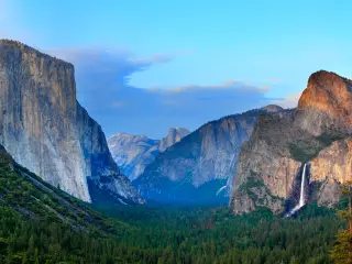
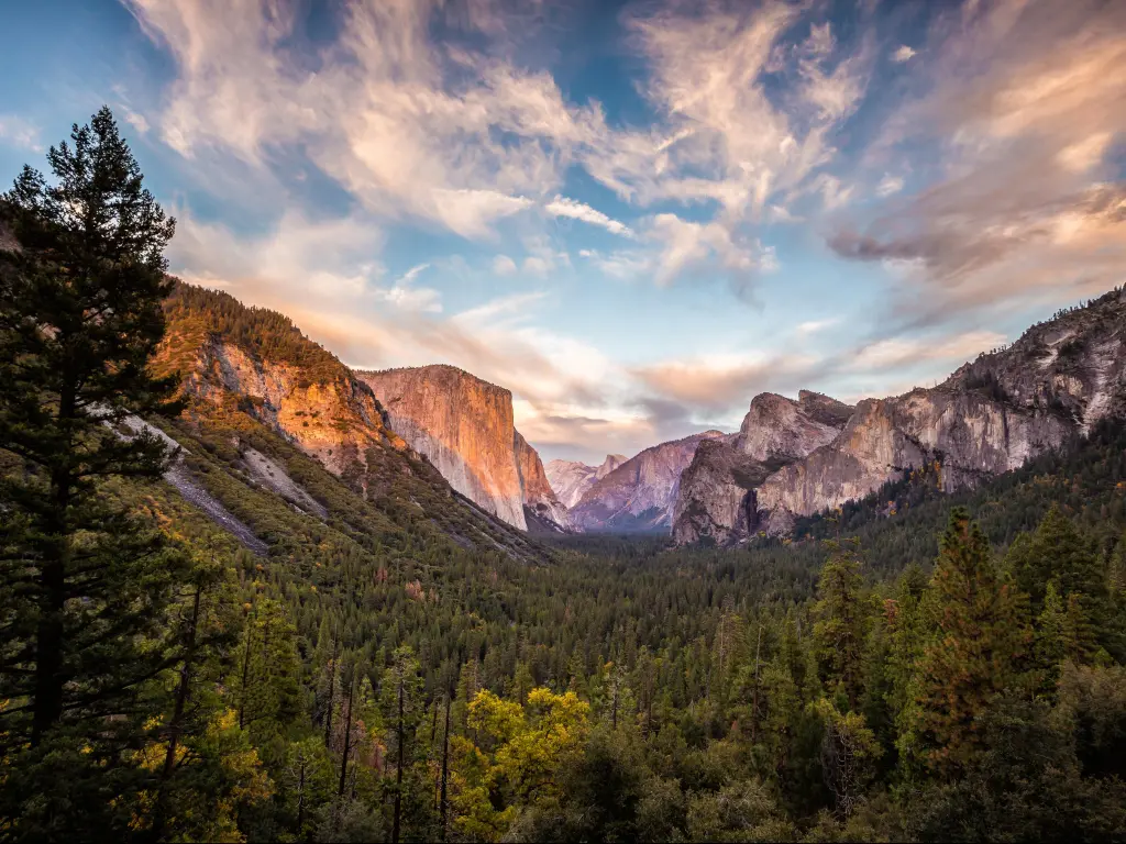
- Tunnel View - A renowned vista in Yosemite, offering breathtaking sights of El Capitan, Bridalveil Fall, and Yosemite Valley's terminus, crowned by the distant silhouette of Half Dome.
- El Capitan - A towering granite landmark in Yosemite Valley, El Capitan beckons rock climbers globally with its imposing facade.
READ MORE - Arch Rock Entrance
2. Big Oak Flat Entrance
What this entrance is good for: There are numerous hiking trails that start from near the Big Oak Flat Entrance, ranging from easy walks to more challenging hikes.
The entrance offers a relatively direct route into Yosemite Valley, the heart of the park, and has very picturesque landscapes.
How to get there: Found on CA-120, this entrance approaches from the west. It provides access to Yosemite Valley and is a popular route for those coming from the San Francisco Bay Area, Sacramento and Northern California locations.
Closest town/city: Big Oak Flat Road (continuation of Highway 120) is about 25 miles from Groveland, a historic Gold Rush town with accommodation options, restaurants, and stores for visitors. It is a popular stopover.
About this entrance: The history of this entrance dates back to the Gold Rush era when the Big Oak Flat Road was developed as a mining route. Following this route was one of the earliest paths for tourists to access Yosemite Valley.
Opening times and seasonality: Big Oak Flat Entrance is typically open year-round as the weather allows.
This entrance has no opening or closing hours, meaning that it is open 24 hours a day, 7 days a week.
Entrance fee stations are here, however, there are automated fee machines, but you can also pay at the visitor center if the payment stations are not open.
Things you need to know: Often the Big Oak Flat Entrance and surrounding area might experience slightly less traffic than the more popular south entrance - especially during peak times.
Big Oak Flat Information Station is close to the entrance, this station provides visitors with essential information, maps, and often current conditions of trails and roads.
Gas and EV charging is best to be done at a gateway town like Groveland to make sure the vehicle is full up and ready to go. You can find J-1772, CHAdeMO and CCS/SAE type chargers at the Rush Creek Lodge.
The Best Things to See Near Big Oak Flat Entrance
- Big Oak Flat Information Station - An informative hub where visitors can obtain maps, details, and guidance about Yosemite.
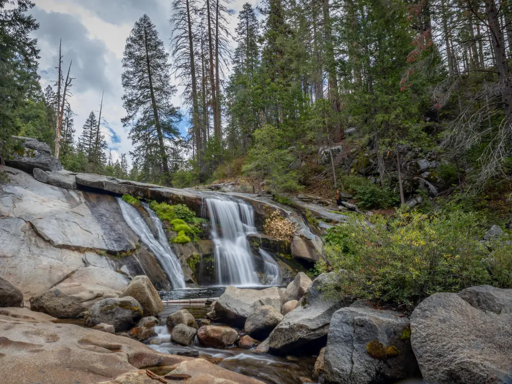
- Carlon Falls - A scenic waterfall trail that gives visitors a tranquil ambiance, distanced from the more crowded regions
- Carlon Day Use Area - Located by the Tuolumne River, it's an ideal location for riverside picnics and relaxation
- Merced Grove - A quieter sequoia grove offering a peaceful experience in contrast to the busier groves
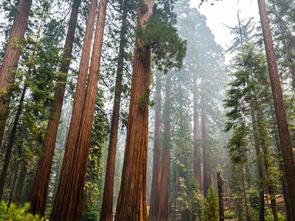
- Tuolumne Grove - A less frequented grove with about 25 mature giant sequoias, reached by a descending trail.
- Big Oak Flat Road - As you drive from the entrance, this scenic route will provide beautiful vistas of the surrounding forests and granite outcrops.
- Tamarack Creek - This creek can be found alongside the Big Oak Flat Road, offering picturesque spots, especially after rainfalls or during snowmelt.
- Cascade Creek Overlook - A viewpoint that offers views and a chance to see the cascading waters of the creek.
- Crane Flat Lookout - Provides a sweeping view encompassing Yosemite's highlands and the iconic Yosemite Valley.
READ MORE - Big Oak Flat Entrance
3. South Entrance
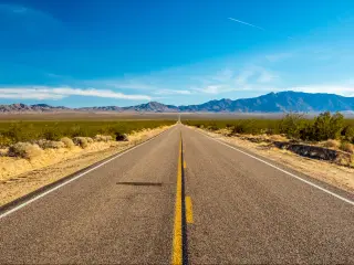
What this entrance is good for: For those traveling from Southern California or coming up from the south, this entrance is often the most direct route to Yosemite. This is a very scenic drive past forested areas, meadows and alongside the Merced River.
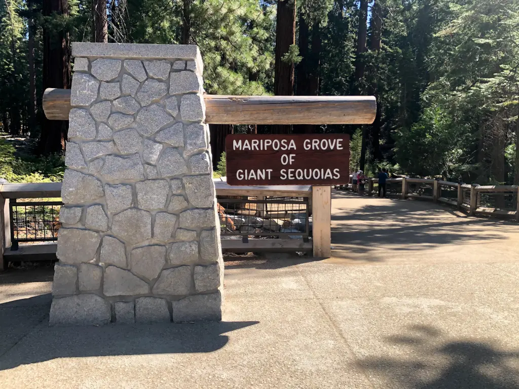
One of the most significant advantages of using the South Entrance is its closeness to the Mariposa Grove of Giant Sequoias, home to over 500 mature giant sequoias, including Grizzly Giant.
Visitors entering from the South can quickly access this iconic grove without driving through the entire park.
How to get there: This entrance is on CA-41 and approaches from the south. It's the most direct entrance if you're coming from Fresno or Southern California
While Yosemite Valley can get congested, especially during peak summer months, the South Entrance and route to Mariposa Grove usually get less traffic than the main routes directly to Yosemite Valley.
Closest town/city: The closest, larger city to Yosemite is Fresno in the Central Valley. It has a range of services and amenities to help with a journey to Yosemite.
Traveling from Southern California, the South Entrance is often a more direct route, especially when avoiding the Sierra mountain passes that can be challenging in winter.
About this entrance: Served as a primary route for visitors approaching from the south in the late 19th century, providing close access to the Mariposa Grove of Giant Sequoias.
Over the years, this entrance has expanded to accommodate the growing number of park visitors.
Opening times and seasonality: The South Entrance is open all day and all year round.
The Mariposa Grove Road is closed in winter due to potential snowfall and some other area might be affected by the weather conditions and experience seasonal closures. However, the South Entrance itself remains open year-round.
Things you need to know: Visitors entering from the South can quickly access the iconic Mariposa Grove without driving through the entire park, so it is particularly popular for those who want to visit here first.
The Wawona Road, which runs from the South Entrance to Yosemite Valley, is a well-maintained, two-lane highway. Extra caution is needed if the weather is bad. However, this is typically a straightforward journey.
Gas and EV charging is best to be done at a gateway town like Oakhurst and Fresno ahead of arriving at South Entrance. However, you can also find EV charging at Tenaya Lodge. Charger Types are the Tesla SuperCharger and J-1772.
The Best Things to See Near South Entrance
- Oakhurst Community Park - A recreational green space near Yosemite, offering playgrounds, picnic areas, and community events for locals and visitors alike.
- Fresno Flats Historical Village - A preserved site near Yosemite that showcases the 19th-century life and history of the Sierra Nevada foothills through restored buildings and exhibits.
- Coarsegold Historic Museum - A museum dedicated to capturing the rich heritage and history of the Coarsegold area, displaying artifacts, documents, and photographs from its past.
- Clovis Botanical Garden - A beautifully landscaped garden in Clovis that highlights the region's native plants and offers a peaceful retreat for nature lovers.
- Yosemite Mountain Sugar Pine Railroad – It offers nostalgic steam train rides that harken back to the logging history of the region.
- Mariposa Grove of Giant Sequoias - Home to over 500 mature giant sequoias, including the famed Grizzly Giant, showcasing the grandeur and age of these ancient trees.
- Yosemite Lakes - A collection of bodies of water in and around Yosemite National Park, provide scenic beauty, recreational opportunities, and vital ecosystems for local flora and fauna.
4. Tioga Pass Entrance
What this entrance is good for: This entrance with the most stunning views has a high elevation, which means it gets quite a bit of snow. This is why it is a great place to start your Yosemite adventure if you are looking to enjoy some cold-weather outdoor activities.
Rock climbing is popular here where the high country around Tioga Pass offers its own set of climbing challenges on granite domes and crags.
Fishing in the lakes and streams along the Tioga Road, such as Tenaya Lake and Lyell Fork of the Tuolumne River, provide opportunities for fishing
Although the entrance is closed in the winter, the area can be accessed on skis or snowshoes and still offers some outdoor fun. Tioga Road then opened up the scenic wonders of Yosemite's high country to more visitors.
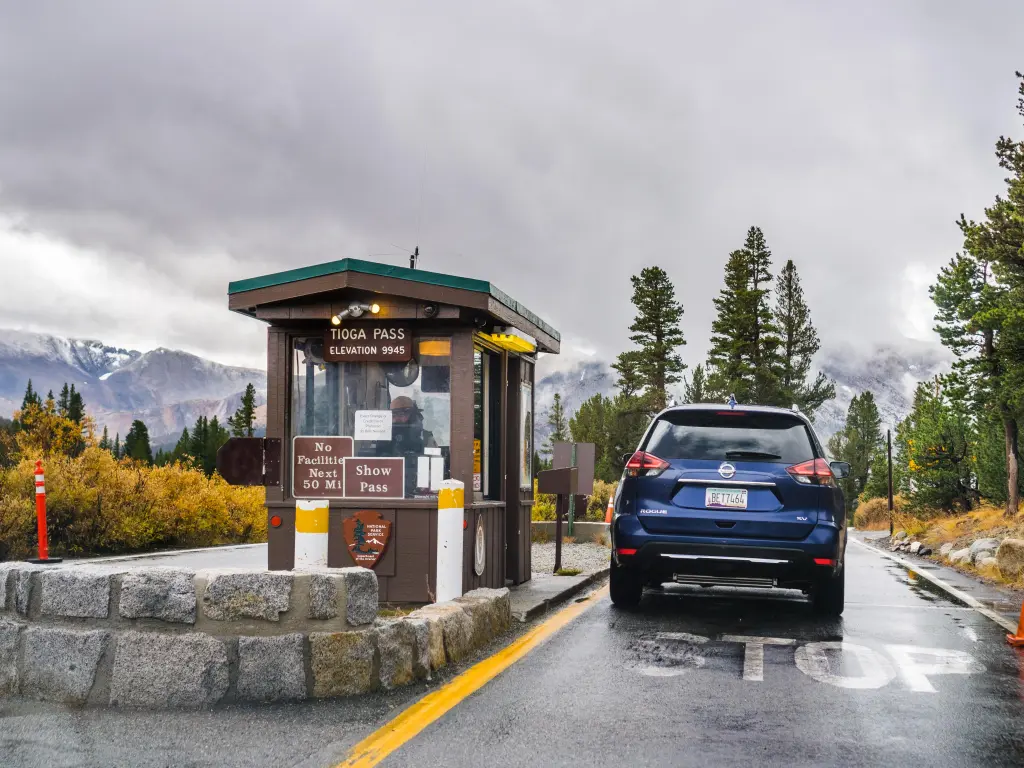
How to get there: Located on CA-120 and approaches from the east. It's the highest pass in California, but that also means it is heavily impacted by snow from late fall until spring.
Closest town/city: Lee Vining, just outside the eastern entrance to Yosemite National Park on the shores of Mono Lake, and offers services for travelers.
About this entrance: Indigenous people originally used it as a footpath through the rugged Sierra Nevada. Then, in the late 19th and early 20th centuries, it evolved from a mining road during the Gold Rush era to an essential transportation route.
Opening times and seasonality: Tioga Pass Entrance is the only park entrance on the east side, and is only open usually between May to October (depending on when the snow melts). Often snowy conditions from November through to spring mean this entrance closes.
Things you need to know: Arriving at Yosemite National Park can be more tricky than the other entrances to Yosemite.
The approach to the pass, especially from the eastern side, involves navigating winding and steep roads. You get breathtaking views, but it can be challenging for some drivers in larger vehicles
While the high country along Tioga Road offers its own set of attractions, it's further away from the iconic sites of Yosemite Valley, like El Capitan, Bridalveil Fall, and Half Dome.
There are restrooms available at the Tioga Pass entrance station. And also can be found along Tioga Road at various trailheads and picnic areas.
If you're planning to enter or exit Yosemite via Tioga Pass, it's a good idea to have any necessary supplies and gas with you since services are limited, especially compared to the more populated areas of the park like Yosemite Valley.
Closest EV charging can be found at Gus Hess Community Park, with J-1772 type chargers available.
The Best Things to See Near Tioga Pass Entrance
- Lee Vining - A small town situated near the eastern gateway of Yosemite National Park, acting as a primary base for travelers exploring Mono Lake and the eastern Sierra region.
- Gaylor Lakes Trail - A moderately challenging trail in Yosemite, leading hikers to a series of picturesque alpine lakes with breathtaking high-elevation vistas.
- Mount Dana - The second-highest peak in Yosemite National Park, Mount Dana offers advanced hikers a strenuous ascent with rewarding panoramic views of the surrounding Sierra Nevada.
- Lembert Dome - A prominent granite dome in Yosemite's high country, Lembert Dome provides a relatively short hike that culminates in sweeping views of Tuolumne Meadows and the surrounding peaks.
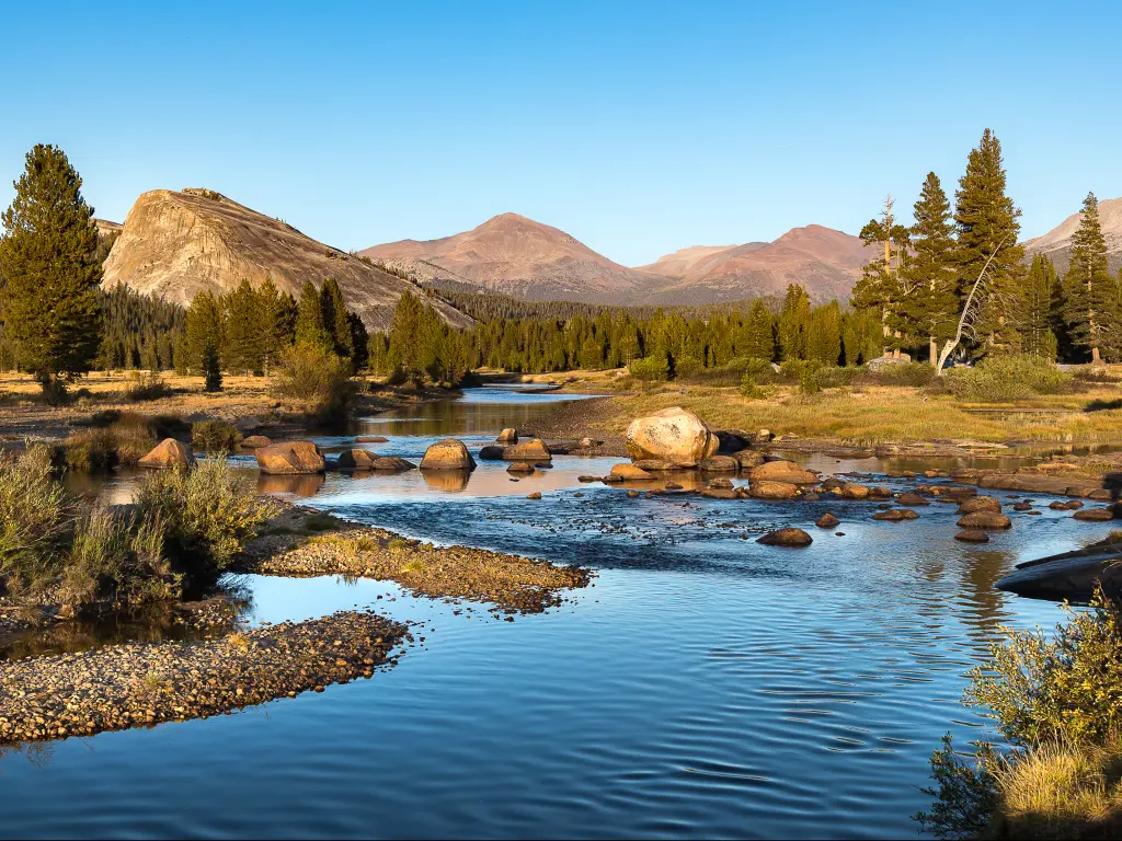
- Tuolumne Meadows - A vast, verdant subalpine meadow in Yosemite's high country, Tuolumne Meadows is a tranquil haven dotted with granite domes and crisscrossed by sparkling streams, acting as a starting point for numerous hiking trails.
- Tioga Road - While this isn't a single "spot" per se, the stretch of Tioga Road near the entrance offers stunning vistas of the surrounding granite peaks, alpine meadows, and forests.
- Tioga Lake - Just outside the park boundary, this picturesque lake is surrounded by granite peaks and offers opportunities for fishing and picnicking.
- Ellery Lake - Also located just before the park entrance, Ellery Lake sits at a high elevation and often has ice even into the early summer.
READ MORE - Tioga Pass Entrance
5. Hetch Hetchy Entrance
What this entrance is good for: For those coming from the northern or western parts of California, the Hetch Hetchy entrance can be a convenient point of access.
Hetch Hetchy is one of the less-visited parts of Yosemite, so visitors can often enjoy a quieter and less crowded experience compared to the more popular Yosemite Valley.
It also offers a different kind of beauty compared to other areas of the park, with stunning granite cliffs and cascading waterfalls
There are several trails in the area. Popular hikes include the trail to Wapama Falls and the Rancheria Falls trail.
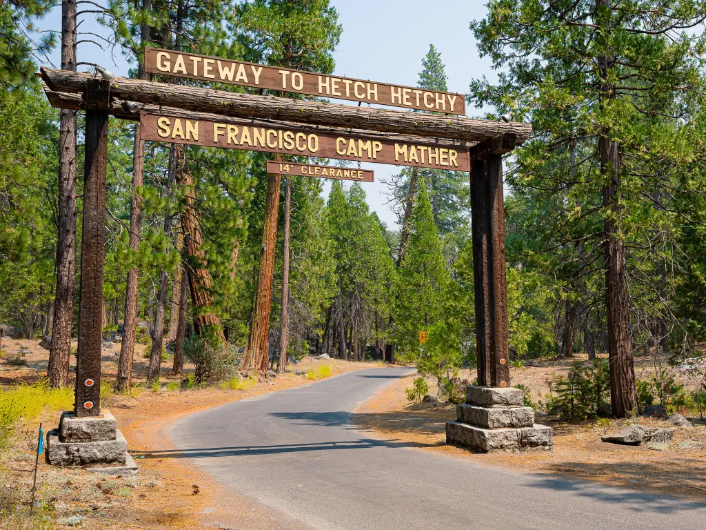
How to get there: This entrance is located on Evergreen Road. From Highway 120 (Big Oak Flat Road), you can turn onto Evergreen Road, which leads directly to the Hetch Hetchy entrance.
Closest town/city: Although Groveland is the nearest significant town to Hetch Hetchy, it is also a drive of nearly an hour to reach the Hetch Hetchy entrance from there due to the winding mountain roads.
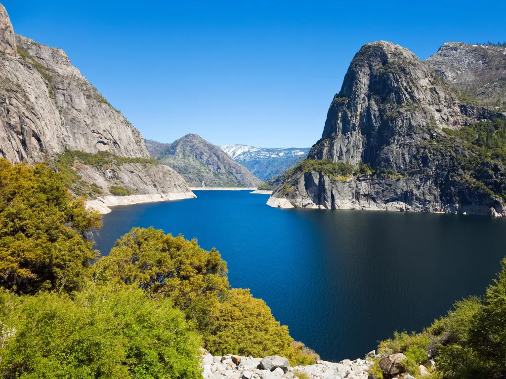
About this entrance: The Hetch Hetchy Valley, celebrated for its beauty similar to Yosemite Valley, became a center of national debate in the early 20th century, during the creation of the O'Shaughnessy Dam, transforming the valley into a reservoir for San Francisco.
The word “Hetch Hetchy” is said to come from the Miwok word “hetchetici,” which is the seeds of native grass used for food.
Opening times and seasonality: This entrance is the only entrance in Yosemite National Park that has seasonal hours, which roughly tally with daylight hours, and you can't access Hetch Hetchy trailheads when the road is closed. Opening hours are listed below:
- April 1 to April 30 - 8am to 7pm
- May 1 to Labor Day - 7am to 9pm
- Day after Labor Day to October 31 - 8am to 7pm
- November 1 to March 31 - 8am to 5pm
Things you need to know: Located to the northwest, this entrance provides access to the Hetch Hetchy area of the park, which is less visited than Yosemite Valley and not used as much as those that are closer to main attractions like Yosemite Valley, which is 1 hour and 15 minutes away from Hetch Hetchy.
The park entrance fee can be paid here, and park passes can be purchased. The same applies to any permits if you want to stay overnight (wilderness permits).
It is a good idea to fill up gas in Groveland or Modesto, although both are nearly 1-2 hours away from Hetch Hetchy.
The closest EV charging point is Evergreen Lodge with charger types J-1772 and Tesla.The Best Things to See Near Hetch Hetchy Entrance
- Poopenaut Valley - A less-trafficked, scenic valley in Yosemite's vicinity, the Poopenaut Valley offers rugged terrain and the wild beauty of the Tuolumne River, perfect for experienced hikers seeking solitude.
- Evergreen Lodge - Located near the Big Oak Flat entrance of Yosemite National Park, Evergreen Lodge is a cozy retreat offering cabin accommodations surrounded by a pristine forest setting, complemented by a range of outdoor recreational activities.
- O'Shaughnessy Dam - A monumental dam that forms the Hetch Hetchy Reservoir in Yosemite National Park, O'Shaughnessy Dam provides water to the San Francisco Bay Area and is set amidst dramatic granite landscapes and waterfalls.
- Wapama Falls - A moderate hike from the O'Shaughnessy Dam leads visitors to Wapama Falls, a cascading waterfall that flows year-round.
- Rancheria Falls - For those looking for a slightly longer hike, the trail to Rancheria Falls offers more remote scenery and a series of cascading waterfalls at the end.
- Hetch Hetchy Reservoir - A sight to behold, surrounded by towering granite cliffs and dotted with waterfalls, especially in the spring when snowmelt increases their flow.
- Kolana Rock - This granite dome rises dramatically from the north side of the Hetch Hetchy Reservoir and offers a stunning visual backdrop to the area.