Is Monarch Pass Dangerous?
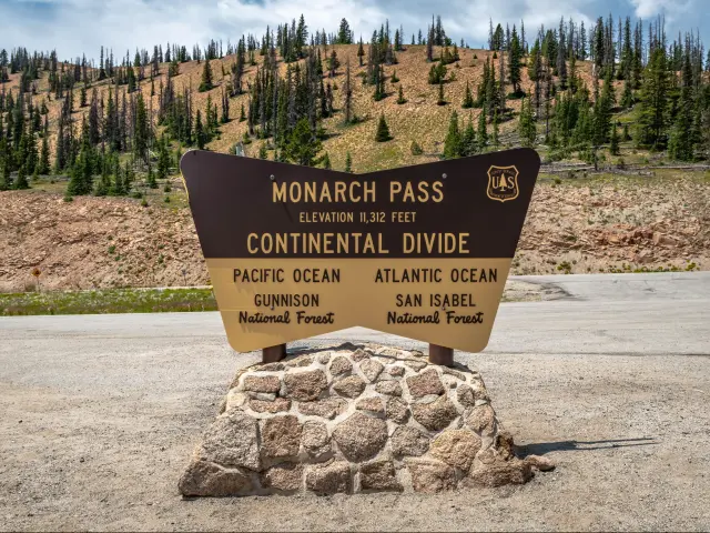
Monarch Pass is a popular high mountain pass on the boundary of Gunnison and Chaffee counties in southern Colorado. It is renowned for its breathtaking mountain scenery, and reaches an elevation of 11,312 feet, making it a great spot for outdoor enthusiasts, whatever the time of year.
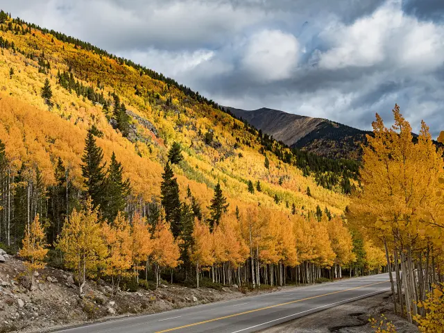
The drive along Monarch Pass is a scenic journey, with the 12-mile adventure from Sargents to Monarch Mountain taking 20 minutes. Monarch Pass is a beautiful drive, but the elevation and turns might make the drive feel challenging for some drivers.
If you are keen to drive along one of the most spectacular mountain roads in the Colorado Rockies and learn more about the safest way to drive it, then keep on reading to discover more about the route, along with useful information and tips to make the journey.
Where is Monarch Pass located, and why might this drive be challenging?
The route itself is perfectly safe if driven carefully, but there are several factors to consider that could make certain drivers nervous.
Given the elevation involved, with the route topping out at 11,312 feet, altitude sickness can be a problem, as it generally occurs at 8,000 feet and above. Spending some time at lower elevations is a way of becoming more acclimatized to the surroundings, allowing time to adjust before hitting the high elevation of Monarch Pass.
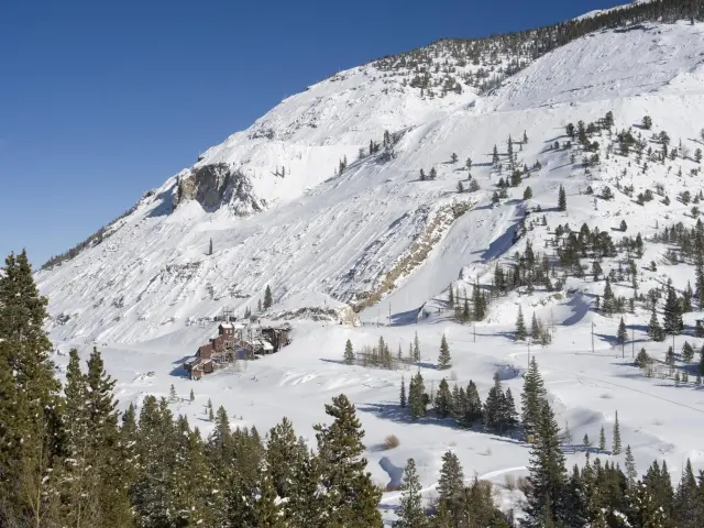
Weather conditions can be an issue, as the pass experiences heavy snowfall and icy conditions in winter, making driving conditions extremely hazardous. The area is also prone to avalanches at this time of year so do check the forecast and keep yourself informed of the latest conditions before setting off.
The Colorado Department of Transport is the best place to learn the latest updates on road conditions. If the weather is an issue, then it is always wise to postpone the trip, driving the pass should be a memorable and enjoyable experience.
The route itself isn't particularly challenging, and there aren't any dramatic hairpin bends, but it can still be windy which can cause problems for nervous drivers. Keep to the speed limit and keep an eye out for signposts advising you on the correct speed limit for tackling the corners.
Monarch Pass is popular with visitors all year round. In the winter months, Monarch Mountain is a popular skiing and winter sports destination, and during summer, the area is popular with hikers and outdoor enthusiasts.
As visitors descend on the area, traffic congestion will increase, as it will also do at weekends and during national holidays.
Wildlife is abundant in the area around Monarch Pass, and it is not uncommon to see deer, elk, and even bears crossing the road. Be sure to drive slowly and watch for animals, especially at dawn and dusk when they are more prevalent.
Driving through Monarch Pass
Monarch Pass runs between Monarch and Sargents, heading north to south through Colorado along US Route 50. In Central Colorado, it's around 130 miles west of Colorado Springs and 200 miles southeast of Aspen.
The 12-mile route can be covered in as little as 20 minutes although you'll want to stop off and savor the incredible panoramic vistas.
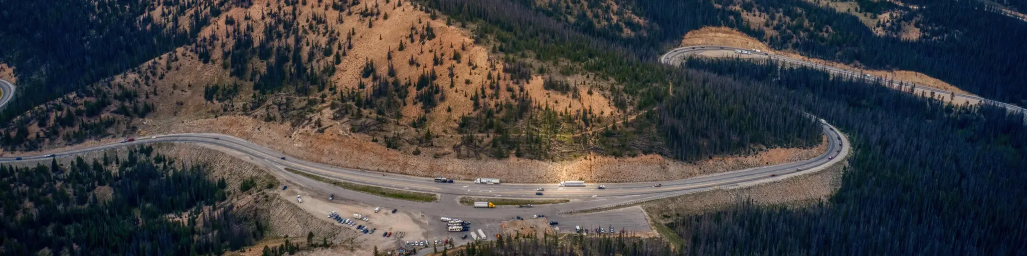
The route begins in Sargents, and leaving the town heading north, you'll pass Tomichi Creek Trading Post before joining US-50 E. As you pass the Mountain Peak of Lime Ridge, the road begins to get more challenging as it starts to ascend, and not long after passing Mt Peck, a little after 10 miles into the journey, you'll arrive at Monarch Pass itself.
Once past Monarch Ridge South, the road crosses the South Arkansas River before heading north towards Monarch Mountain. There are many tight turns and steep gradients, up to 7%, but most passenger vehicles should have no problem making the trip.
There are some steep drop offs but the drive is not particularly dangerous and when you reach the pass, you'll see why it was chosen to feature in the popular movie Fast and Furious 7.
Things to know that can impact the drive through Monarch Pass
A drive along Monarch Pass is a relatively straightforward experience but it's worthwhile getting familiar with the route before you set off.
The road is of good quality and for the majority, is two lanes, one in each direction. On some of the inclines, there is an extra lane for ascending vehicles, allowing slower vehicles to keep to the right and allow overtaking.
There are also more lanes at certain points along the way, including the Monarch Pass recreation area, allowing vehicles to turn off for the trailhead and aerial tram without slowing the other traffic.
You will find that passing is prohibited along certain sections of the route, in the interests of safety, although passing is permissible on some of the straighter sections where visibility is clearer.
When travelling on high altitude mountain roads it is important to drive safely and stick to the speed limits. On the open mountain highways, the limit is generally 40 MPH but this varies through various corners and drops to 30-35 MPH although conditions will dictate the speed to safely navigate the bends.
The limit in residential districts along the way is 30 MPH. The Pass can be very windy although you won't encounter drastic switchbacks and the sharpest turn is after Monarch Pass heading towards Monarch Mountain.
The road itself is normally paved and is kept in good repair, but despite the route being open all year round, it often has a covering of snow in winter, which can lead to road closures and tricky driving conditions.
Given the altitude, a large truck ramp project was undertaken in 2022 and other general road maintenance works can lead to reduced speed limits but rarely result in road closure.
There are no gas stations on Monarch Pass so it is important to fill up beforehand. Traveling from the east you can stop at Gunnison, and from the west, there are service stations at Salida and Poncha Springs.
Once you reach the summit, the Monarch Pass gift shop has services, including restrooms and it's a good place to stock up on snacks and drinks for the remainder of the journey.
Cell Phone coverage isn't reliable on the route, so be sure to plan your journey in advance and have a map available in your vehicle as you can't rely on your phone or GPS and how good a signal you will receive is dependent on your service provider.
As already mentioned, the weather can cause serious issues when driving through the mountains at high altitudes so the Colorado Department of Transport official website is a good source of information to find out about the latest road conditions.
If you are planning on driving the route in winter, winter tires and chains are a requirement. The Colorado Department of Transportation enforces a ‘Traction Law' in hazardous conditions, and you'll have to install mud or snow tires or use chains as a legal requirement.
Tips to drive through Monarch Pass in the safest way
A drive along Monarch Pass is a fantastic experience, and our tips below will ensure your journey runs as smoothly as possible:
- Avoid traveling at night, for improved visibility, plan to drive during daylight. You will also get to see the incredible views.
- Reduce the risk of traffic congestion by avoiding driving and weekends and holidays.
- Check for road closures and adverse weather conditions by using resources like the Colorado Department of Transportation (CDOT) and the National Weather Service.
- Make sure you have winter tires or chains available.
- Make sure you have adequate fuel for your journey. Fuel up at Salida or Gunnison before ascending Monarch Pass.
- Do not attempt to drive in heavy snowstorms and blizzards. Consider staying in Salida or Gunnison allowing the bad weather to pass.
- Do a "digital tour" by navigating through Google Street View, allowing you to familiarize and visually acquaint yourself with the route in advance.
- If possible, have two designated drivers to share the load so you can stay fresh.
- Be mindful of HGVs and their limitations on steep inclines. Look ahead for heavy trucks crawling along the slow lane. Anticipate this and merge into the fast lane, ahead of them.
- In high winds, the Monarch Pass Aerial Tram doesn't operate. It is also only open from May until Fall.
Alternatives to driving yourself through Monarch Pass
While Monarch Mountain doesn't have its own public shuttle service available, it is possible to travel along the pass by bus. There are services running from Salida and Gunnison to Monarch Mountain, allowing you to enjoy the best of Monarch Pass in a more relaxed fashion.
Another alternative is to take a taxi along the Pass, and Rocky Mountain Taxis serve the whole of Chaffee County and you can let someone else do the driving and take in the local knowledge as you soak in the amazing views.
If you are feeling energetic, you could choose to take to 2 wheels and cycle along the Pass at your own pace, or even put on your hiking boots and walk the entirety of the pass, taking in some of the various trails that skirt through the mountains.
Best time to drive through Monarch Pass
Visiting Monarch Pass in late spring and summer will give you the best weather for exploring the area, with the trailhead being easily accessible close to the gift shop.
The weather is warm and sunny and the roads will be dry, although summer also sees an influx of hikers in the area, so be mindful of them strolling in the road. Higher elevations mean increased UV exposure, so it is important to always wear sunscreen, sunglasses, and other clothing to protect yourself from sunburn.
However, even over the summer months, in the mountains, the temperatures can drop quickly so be sure to bring extra layers. The average daily temperature in July is around 55 degrees Fahrenheit.
Winter brings severe snowfall and ice to the area so do check conditions and take the relevant precautions if you are planning to visit at this time.
Avalanche risks are real, so monitor the forecast before setting off and remember that there are fewer daylight hours available to enjoy the stunning mountain scenery and mesmeric views.
Nearby Monarch Mountain is a popular spot for skiers and snowboarders enjoying the winter snow, so be aware of backcountry skiers who may be close to the road.
Services in the area may be limited over winter, so ensure you bring ample supplies to keep you going for the trip and be sure to bring suitable clothing if you plan to head outdoors as the average temperature drops to 22degrees Fahrenheit.

Sasha Yanshin – Founder & Lead Driver
Sasha Yanshin has spent the last 15+ years mapping and driving thousands of miles across Europe and the US. As the Founder and Lead Driver of Lazytrips, he brings an analytical approach to road-tripping, sharing meticulously tested routes, realistic drive times, and the hard-earned logistical reality of the open road.
Read full bio