Where does the Oregon Trail start and end?
If you've ever wondered how the pioneers conquered the beautiful and rugged Midwest terrain, then a road trip along The Oregon Trail is the ideal way to find out. Learn all about the challenges they faced as you travel along this historic emigrant wagon route across the US.
The Oregon Trail starts outside Kansas City in Independence and weaves its way across six states before arriving at Oregon City. The 2,170-mile route takes you on an incredible journey across amazing landscapes, following in the footsteps of history.
Traversing six states, the route spans from the Missouri River in the East through incredible scenery before reaching Oregon. A drive along the Oregon Trail will take you off the beaten track and is a valuable history lesson and a fantastic road trip. Continue reading to discover all the wonderful sights and attractions you will encounter along the way.
Where is the Oregon Trail located and where does it start and end?
The Oregon Trail originated over 200 years ago as a trade route for fur traders in the US. The route today begins in Independence in the state of Missouri, heading west across the country through Kansas, Nebraska, and Wyoming before reaching the final destination of Oregon City.
The route itself is a fantastic way to explore the American Mid-West, learning about the different cultures and the journey of discovery the pioneers undertook in the early 19th century.
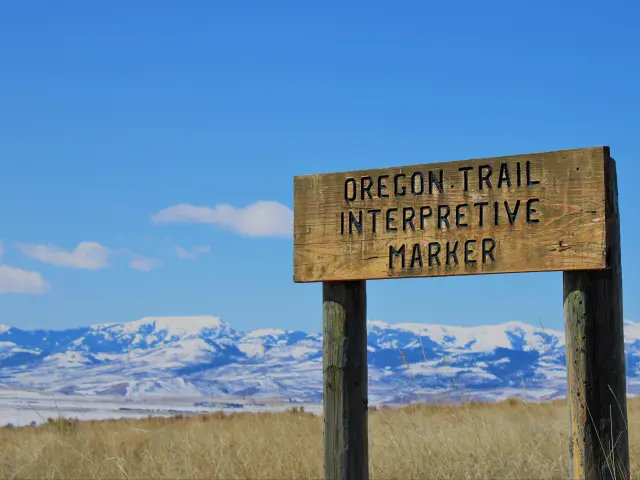
The Oregon Trail of today is a National Historic Trail, and the route has an abundance of places to stop and learn all about its importance in the history and development of the USA.
The starting point of the Oregon Trail
The Oregon Trail begins in the city of Independence, the fifth largest in Missouri. The city itself was named after the Declaration of Independence, and due to its position on the Missouri River, it became vitally important to merchants and adventurers. It was also home to two important Civil War battles.
Independence was the starting point for The Oregon, Santa Fe, and California Trails, giving it the name Queen City of the Trails, and the National Frontier Trails Museum is a great place to learn all about the history of the area, which was also the home of the renowned outlaw and bank robber, Jesse James.
Independence is also known as the childhood home of US President Harry S Truman, and the birthplace of his wife and First Lady Bess Truman.
The Harry S Truman National Historic Site, based in his old home, along with the Presidential Library and Museum, are both excellent places to learn all about the life of the ex-president.
A visit to Independence today should include a trip to Independence Square, in the heart of the city, it's the place to go for shops, restaurants, and impressive historical buildings. It has a thriving arts and cultural scene, along with its many museums, galleries, and theaters.
The endpoint of the Oregon Trail
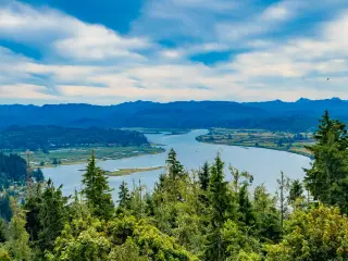
The final destination along the Oregon Trail is Oregon City, situated in Clackamas County. It is the oldest city west of the Rocky Mountains and was founded almost 200 years ago by an early fur trader, John McLoughlin.
Visiting Oregon today, you can tour McLoughlin's old home, which he built in 1846 and is now a museum telling the story of the man himself and what life was like in the fur trade, along with the history of the area at that time.
The city is also home to the unique Municipal Elevator, the only vertical street railway in the US, and makes an interesting way to ascend from the waterfront.
You can learn more about the area's origins at the Museum of the Oregon Territory. Here you can discover how the landscape changed with the arrival of Europeans and their impact, and the Oregon Trail.
The city is also home to the largest waterfalls on the West Coast, and you can take a stroll or a boat tour to get up close to the Willamette Falls.
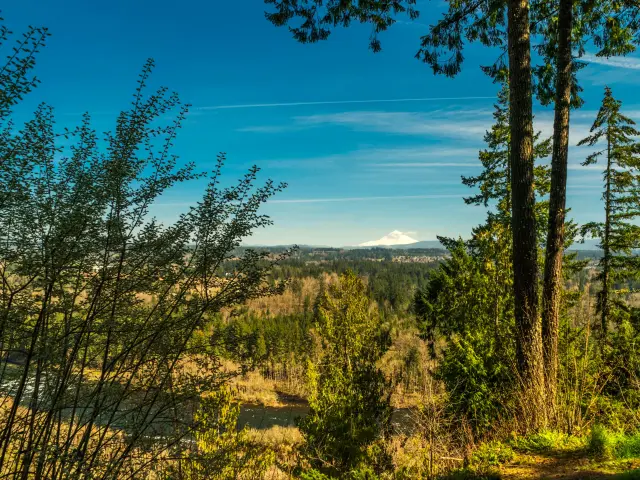
Oregon is an ideal destination for exploring the outdoors and the Clackamas River Trail Is the perfect way to enjoy views of the mountains and across the river.
Did the Oregon Trail change over time?
The Oregon Trail originated back in 1811, as fur traders established a route for their trade, but it was initially only suitable for those on foot, or on horseback.
As trade increased, the trail was cleared for wagon use in 1836, and it began in Independence, Missouri, heading to Fort Hall in Idaho. As the traffic along the Trail increased, more and more settlements appeared.
The Trail continued to grow but could not withstand the increase in wagons and livestock and the ruts of the wagon wheels can still be seen to this day.
Bridges and ferries were introduced to make river crossings safer, although as trade increased, so did the attacks on those on the trail by Native Americans. This led to the US Army patrolling the trail to try and curb the attacks.
The arrival of the railroad in 1869 saw the use of the Trail start to decline, although it still had an important role to play as settlers staked their claims in the American West. It played a major part in the development of the US and its economy and is a reminder of the hardship faced by those that established the Trail in their search for a better life.
Although the Trail still exists to this day, it is no longer used for travel, although it is still possible to walk large sections of the original route.
Where can I start my Oregon Trail road trip?
The most popular starting point for the Oregon Trail is Independence in Missouri, although there is no reason why the Trail couldn't be tackled in the opposite direction, starting in Oregon City.
However, you may not have time to complete the route in its entirety and may only wish to complete a section of it. Our table below provides a helpful guide on getting there from various major cities.
| Major city/via point | Miles/time From Independence | Miles/time From Oregon City |
|---|---|---|
| St Louis, MO | 240 miles | 2,225 miles |
| Chicago, IL | 510 miles | 2,495 miles |
| Nashville, TN | 550 miles | 2,535 miles |
| Portland, OR | 2,000 miles | 15 miles |
| Seattle, WA | 2,175 miles | 190 miles |
| San Francisco, CA | 2,615 miles | 630 miles |
Hiking the Oregon Trail
Hiking the Oregon trail is a serious walking expedition, which will be extremely challenging, though ultimately a very rewarding experience. The trail itself covers over 2,170 miles and can take up to 5 months to complete.
If you are up for the challenge, then it is important to ensure you are in good physical condition and have planned and trained accordingly.
It is important to remember that although the Oregon Trail is a National Historic Trail, large areas of the route pass through private property, and landowners do have the right to deny access to their land.
Contacting the landowners in advance and obtaining their written permission will allow you to complete the route safely and legally. The National Park Service website lists all the landowners you will need to gain permission from.
The route takes you through challenging, rugged terrain and you will undoubtedly be walking in all manner of weather conditions, which can also be mentally challenging.
It is important to be walking and hiking regularly over a good distance before undertaking a trek of such proportions. It is also much more enjoyable to undertake such a journey with a partner or friend, creating memories that will last a lifetime.
Given the length of the route, then it may be that you choose to walk a section of it, and doing this with a guide is an excellent option, as they will take care of the route planning and allow you to simply enjoy the wilderness.
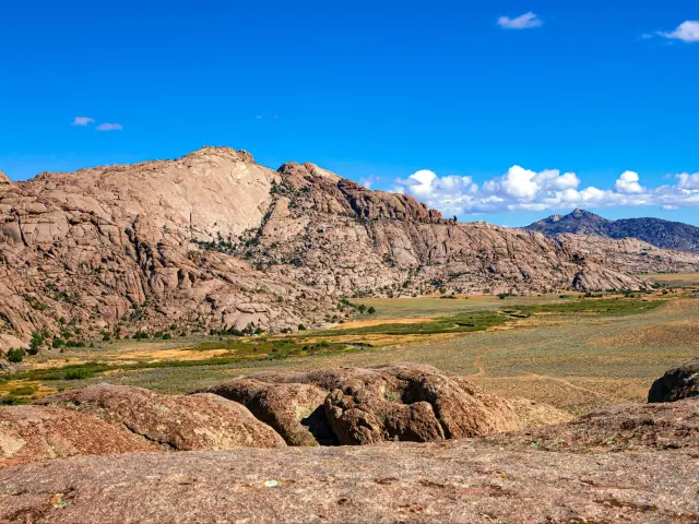
In Wyoming, the North Platte River Crossing, Bedlam Ruts, and the Independence Rock State Historic Site are some of the most popular parts of the Trail.
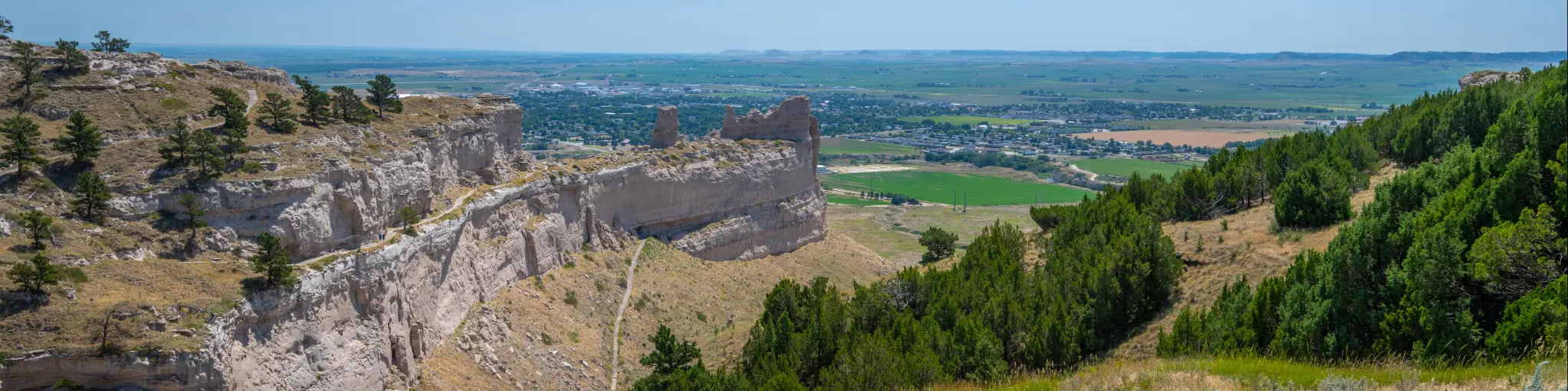
In Nebraska, a trip up California Hill, and visiting Scotts Bluff Monument are highlights along this part of the route. Massacre Rocks State Park and Snake River Trail are well worth attempting in Idaho. And in Oregon, Keeney Pass Interpretive Site and Echo Meadows are popular sections to complete.
How long does it take to drive on the Oregon Trail?
This incredible 2,000-mile route can be driven in 31 hours, but there would be little fun in that, and most people allow 2-3 weeks to complete the Trail, giving plenty of time to appreciate all the sights and attractions along the way. A drive of such magnitude is there to be savored and enjoy everything it has to offer.
A lot of the drive occurs in quite remote areas, where you'll have the road to yourself and traffic should not cause a problem. Around major cities such as Lincoln, and Boise, on the I-80 and I-84, respectively, traffic will be heavier, so traveling these sections outside of peak hours will make the journey more enjoyable.
The route begins in Independence, Missouri, only 10 miles east of Kansas City, and heads north along the I-29 then heads left onto the IA-2 at Nebraska City before taking the I-80W to Lincoln.

The route is quite straightforward as it heads along the interstate through the wilds of Nebraska past North Platte, and after passing Ogallala, take a right onto US-26 heading northwesterly for around 120 miles before arriving in Scottsbluff.
Leaving Scottsbluff, you'll soon reach the border and cross into Wyoming, and after a further 60 miles, head north on the I-25 with incredible views over the vast plains in every direction and a little over an hour later you'll arrive in Casper.
Leaving Casper, head south on WY-220 for around 70 miles until you reach Muddy Gap before taking the US-287 N for a similar distance and then WY-28 and US-30 W passing Bear Lake before reaching Soda Springs, a little over the halfway mark of the trip.
Continue west passing Lava Hot Springs before joining the I-15 N to Chubbock and then heading left onto the I-86 past Snake River and American Falls, before it merges into I-84 W and continues for around 170 miles until you reach Boise.
Leaving Boise, continue on the same route heading west for 170 miles crossing into Oregon, and arriving at La Grande. Continue onwards through the Umatilla Reservation, and the road will soon run parallel with the Columbia River for almost 160 miles before reaching Portland, and from here you'll head south on I-205S for around 15 miles until you reach the final destination, Oregon City.
Attractions and scenic areas on the Oregon Trail
As you'd expect with a route passing through so many states, the Oregon Trail offers miles of spectacular scenery, with countless historical and cultural attractions along the way. With so many to choose from, here are some of our recommendations to help you as you plan your itinerary:
- National Frontier Museum, Independence, MO - Situated in a former flour mill, the museum has a variety of exhibits, including a replica covered wagon, tools, and clothing. It tells the story of the three western trails that started in Independence and is a great place to learn about the history of the area.
- Shoal Creek Living History Museum, Kansas City, MO - Visit this incredible recreated village, demonstrating what life was like for our ancestors in 19th Century Kansas.
- Lewis and Clark Interpretive Trails and Visitor Center, Nebraska City, NE - A museum dedicated to the Lewis and Clark expedition through Nebraska in 1804-1805, where you can learn all about their journey with an interactive exhibition.
- Fort Kearny State Historical Park, Kearny, NE - Museum and Historical Park on the site of a former military fort that emerged to protect travelers on the Oregon Trail
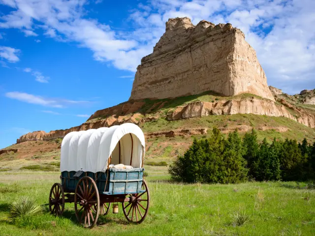
- Courthouse and Jail Rocks Historical Marker, Bridgeport, NE - Unique rock formations shaped like a courthouse and jail, used as landmarks by early pioneers.
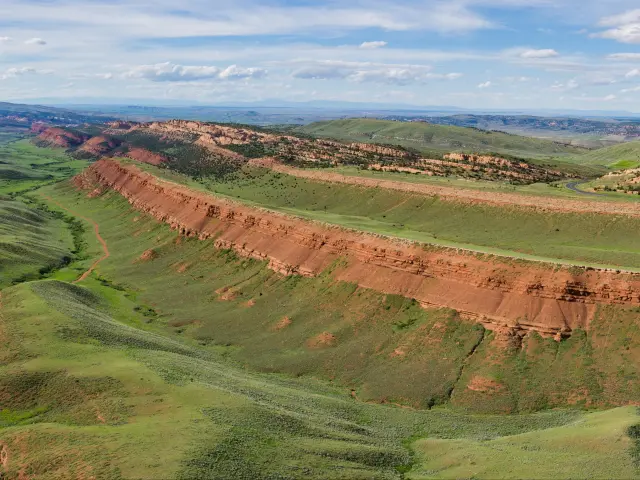
- Chimney Rock National Historic Site & Museum, Bayard, NE - This incredible 485-foot rock spire formed from a volcanic neck was a landmark used to guide early travelers on The Oregon Trail and is a popular attraction today.
- Scotts Bluff National Monument, Gering, NE - The most distinguishable of 5 buttes, standing over 800 feet tall. The visitor center houses many exhibits on the area's geology.
- Fort Laramie National Historic Site, Fort Laramie, WY - This preserved former trading post is now home to a museum, visitor center, and several recreated buildings, explaining the history of the fort and the Native Americans who inhabited the area.
- Register Cliff State Historic Site, Guernsey, WY - Visit this incredible sandstone cliff where early pioneers carved their names and messages into the rock, which stands 100 feet above the North Platte River Valley
- Guernsey Ruts, Guernsey, WY - This historic site can be reached via a short trail and is a mile of ruts made by the wheels of wagons traveling across the rocks as they made their way along the Oregon Trail.
- Devil's Gate, Alcova, WY - An impressive narrow rock formation formed by the Sweetwater River, 370 feet deep and 1,500 feet long.
- America Falls Dam, America Falls, ID - Built in 1927 to provide irrigation water, the dam on American Falls Reservoir is popular with watersports enthusiasts, especially boating and waterskiing.
- Three Island Crossing State Park, Glenns Ferry, ID - The site of an early crossing point over Snake River for pioneers, the islands were a safer place to cross and avoid strong currents. Today the area has many hiking trails and popular camping areas.
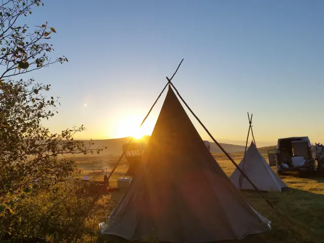
The drive passes many outdoor attractions, routes, and trails with many offering overnight campsite facilities. What better place to spend a night under the stars reliving the experience of the early pioneers and traders who would have done exactly the same over 200 years ago.
The main stopping points along the route are:
- Platte Falls Conservation Area, Platte City. MO - Popular for hiking, fishing, and wildlife spotting, it's a beautiful place to enjoy the outdoors with its variety of wetlands and forests.
- Loess Bluffs National Wildlife Refuge, Forest City, MO - Established by former President Franklin D. Roosevelt back in 1935, this 7,350-acre reserve serves as a refuge for breeding and migrating birds.
- Windlass Hill, Oshkosh, NE - A hill in Nebraska famous for its horse-powered winch, a windlass, that hauled wagons up the hill from the pass below. This was also a renowned spot for a Native American ambush. Visit the viewing platform for a glorious panoramic view of the surrounding area.
- Ayres Natural Bridge Park, Douglas, WY - This park in Wyoming is home to a natural arch bridge, reaching over 100 feet long and standing 30 feet high, formed over millions of years as the water from the creek below slowly eroded the limestone.
- Red Canyon Scenic Overlook, Lander, WY -Witness incredible views over Red Canyon, formed by natural erosion over time, the canyon is a popular hiking spot and stretches over 10 miles.
- Geyser Park, Soda Springs, ID - Enjoy a swim and a soak in the geothermal geysers, visit the mud pots, and learn more about these impressive natural wonders in the visitor center.
- Lava Hot Springs Pools, Lava Hot Springs, ID – The natural geothermal springs are said to aid muscle relaxation and be a great stress reliever as you soak in the water heated up to 112°F
- Shoshone Falls Park, Twin Falls, ID – The waterfall at Shoshone is one of the largest in the US, standing 212 feet tall and over 900 feet wide. Take a trip up to the scenic overlook to get the best view of the falls and the best photo location.
- Thousand Springs State Park Malad Gorge Unit, Hagerman, ID- Witness the incredible sight of over 1,000 springs flowing out of the canyon walls into the Malad River, which through natural erosion over millions of years, has forged the 13-mile-long Malad Gorge. The springs are a popular spot for a swim.
- Farewell Bend State Recreation Area, Huntington, OR – Take a Trek along the Farewell Bend Trail, along the banks of Snake River and keep your eye out for Elk, Coyotes, and Eagles before spending a night under the stars at one of the parks 101 campsites.
- Deadman Pass Lookout Area, Pendleton, OR – Situated in the Blue Mountains of Oregon, the Deadman Pass Lookout is a stunning viewpoint over the surrounding wilderness. The pass was named after a wagon driver ambushed and killed by a Native American tribe.
- Starvation Creek State Park, Cascade Locks, OR – This small State Park has many popular trails. You can trek to Starvation Falls, or for the more adventurous, take a hike on the Historic Columbia River State Trail with impressive views over the river gorge and neighboring mountains.
- Wahclella Falls and Trail, Cascade Locks, OR – The trail at Wahclella is a 2.4-mile loop that takes in the mightily impressive 350-foot waterfall. The trail is suitable for all the family and is an enjoyable walk, taking you through forests and canyons, with places to cool off with a swim in the Columbia River.
Things to know that can impact your driving time
Here are some of our top tips for making the drive along the Oregon Trail as enjoyable and stress-free as possible:
- Plan your route so you don't miss out on the historical landmarks.
- Familiarize yourself with the history so you can appreciate the stops along the route.
- Similarly, stop at visitor centers and museums to learn more about the historic trail.
- Choose an economical car to minimize refueling stops and to save money.
- Drive on Sundays, when there's likely to be less traffic.
- Stock up on snacks! Snacks and a good playlist are keys to the perfect road trip.
- Remember, sections of the Oregon Trail run through private land, so stick to sections you know are open to the public.
- Drive the Oregon Trail in spring, summer, or fall. But consider that during summer popular sites will be more crowded.
- We don't suggest making the drive in winter, with snow and ice, the drive can be challenging, especially in mountainous regions.
A trip on the Oregon Trail is a chance to experience the beauty of the mid-west and the Great Plains through some of the most incredible parts of the US.
Driving the entire length of the Trail is a major achievement and if you are seeking an adventure that is challenging, rewarding, and educational, then this is the perfect trip for you!

Sasha Yanshin – Co-Founder & Lead Driver
Sasha Yanshin has spent the last 15+ years mapping and driving thousands of miles across Europe and the US. As the Co-Founder and Lead Driver of Lazytrips, he brings an analytical approach to road-tripping, sharing meticulously tested routes, realistic drive times, and the hard-earned logistical reality of the open road.
Read full bio