Can You Drive To Dauphin Island?
If you are looking for an island getaway then Dauphin Island, off the coast of Alabama is the ideal coastal vacation. You can drive to Dauphin Island from mainland Alabama. Miles of pristine beaches, quaint shops and excellent restaurants make Dauphin Island a top road trip destination.
You can drive to Dauphin Island from mainland USA by taking the I–193 over the Dauphin Island Bridge if you're coming from Mobile, Alabama or Mississippi. Those coming from Gulf Shores or Florida can take the more scenic car ferry from Fort Morgan.
Read on to find how you can drive to Dauphin Island. Discover which route is faster, how to use the Mobile Bay ferry and how long the drive to Dauphin Island will take you.
Is it possible to drive to Dauphin Island?
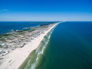
The small Dauphin Island is only three quarters of a mile wide at the widest point. Dubbed the Sunset Capital of Alabama, the island is the southernmost point of the state located 3 miles south of Mobile Bay.
You can drive to Dauphin Island by crossing over the one long bridge that connects it to mainland Alabama - take the I-193 over the 3-mile long Dauphin Island Bridge (that used to be called Gordon Persons Bridge) to get across.
If you're coming from anywhere other than the other barrier islands to the south of Bon Secour Bay, the bridge is the fastest option - even coming over from Pensacola, Florida, the route via Mobile and over the bridge is half an hour faster at about 1 hour 30 minutes despite being a full 30 miles longer.
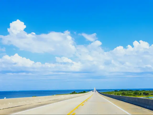
The Gordon Persons Bridge is a two-lane extension of the Alabama State Route 193 which has dazzling views across Mobile Bay, Dauphin Island and the Alabama coastline.
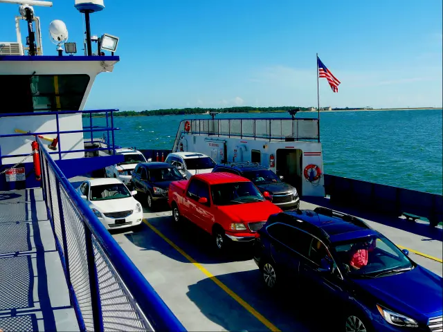
The second route will take you longer unless you're crossing over from Gulf Shores. This route uses the small car ferry to get you and your across to Dauphin Island from Fort Morgan. The drive to Fort Morgan is often touted as the Gulf Coast's Most Scenic Drive.
From Gulf Shores follow State Route 180 to Fort Morgan and cross the stunning Mobile Bay on the car ferry. The ferry will take you over to the Mobile Ferry Landing on the eastern tip of the island and you can get around from there.
How to get to Dauphin Island?
Getting to Dauphin Island can be done by using the bridge or the ferry wherever you're coming from. Most people will use the bridge because it's easy and is the fastest route from everywhere you may be coming from.
To get to Dauphin Island from some popular nearby locations, check the directions below.
The route to Dauphin Island from Mobile, Alabama
- Take the I-10 headed west from Mobile
- Take exit 17A-17B and follow AL-193 south towards Dauphin Island
- Keep following State Route 193 (Dauphin Island Parkway) all the way to Cedar Point
- Cross the Dauphin Island Bridge to the island
The ferry route to Dauphin Island via Fort Morgan
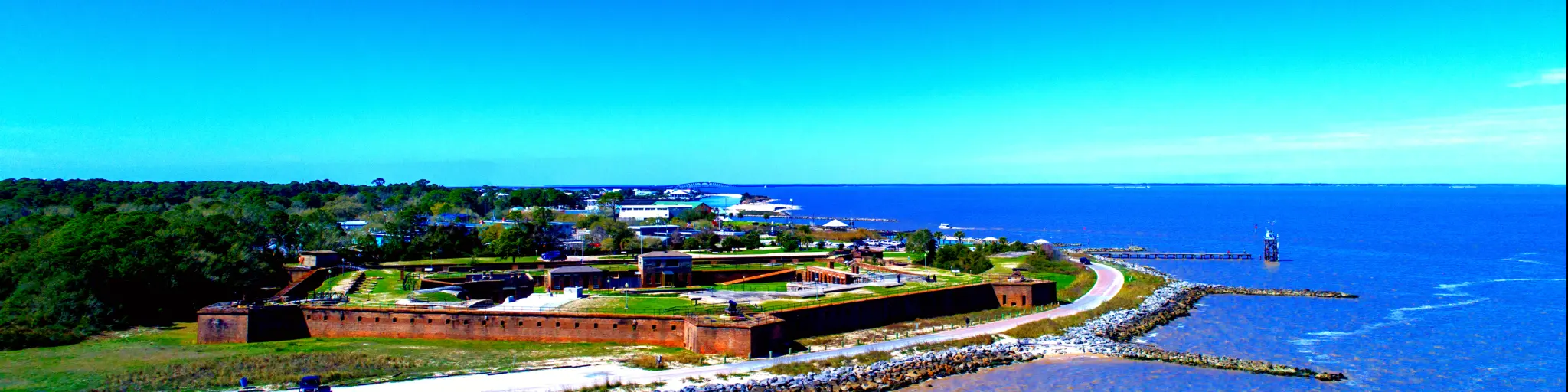
The ferry landing is located at historic Fort Morgan. Below are directions to reach the Fort Morgan ferry port from Mobile instead of taking the faster route over the bridge
- Follow the I-10 east out of Mobile across Mobile Bay
- Take Exit 49 onto the Baldwin Beach Express (Route 83) headed south
- Join onto the Foley Beach Express headed south as you pass Summerdale
- Take the Coastal Gateway Boulevard across to the Gulf Shores Parkway south past Jack Edwards Airport
- When you reach Gulf State Park, take Route 180 west to Fort Morgan
The ferry service runs two ferries - the Fort Morgan and the Marissa Mae Nicole but make sure you check the schedule ahead of your trip - only one ferry runs from Labor Day to Memorial Day and you may have to wait for an hour and a half if you turn up at the wrong time.
How long does it take to get to Dauphin Island?
Getting to Dauphin Island from mainland Alabama is fast - it only takes a few minutes to cross over the Dauphin Island Bridge and the ferry takes about 40 minutes to cross the bay.
Most people will come to Dauphin Island via Mobile or Pensacola and here's how long it will take you from these two cities:
- Mobile - 40 minutes (33 miles)
- Pensacola (fast route over the bridge) - 1 hour 30 minutes (92 miles)
- Pensacola (slow ferry route) - 2 hour 45 minutes (63 miles)
For those driving from further afield, here are some popular starting points:
- New Orleans, Louisiana - 2 hours 30 minutes (145 miles)
- Birmingham, Alabama - 4 hours 20 minutes (290 miles)
- Atlanta, Georgia - 5 hours 20 minutes (360 miles)
Remember that you have to arrive for the ferry 30 to 60 minutes before your ferry departs so waiting to board extends the time it will take you to cross over. Queues can also be lengthy during weekends and holiday times over the summer.
Things you need to know about driving to Dauphin Island
Mobile Bay Ferry Crossing
There are only two ferries that run from Fort Morgan to Dauphin Island - the Fort Morgan ferry and the Marissa Mae Nicole ferry and both are operated by the Mobile Bay Ferry company.
A ferry departs Fort Morgan for Dauphin Island every hour and a half, starting at 8:00 am. Times change according to the time of year and additional crossings are added to the scheduled over the summer months.
In adverse weather conditions ferries may be cancelled at short notice. Storms and rough sea conditions can make the ferry journey dangerous, so call in advance to check the ferry is still running if the weather looks poor.
Depending on the tide, low clearance cars may not be able to board and wait until the tide changes as the small ferries may have clearance issues with getting on and off the boat.
The ferries are well suited to regular cars - if you have a large vehicle or a large trailer, you may not be able to board and have to take the long route across the Dauphin Island bridge instead. Check the Mobile Bay Ferry website for details on the requirements.
Fares for the Mobile Bay ferry crossing
These are accurate at the time of writing - please check with the ferry company to get the most up-to-date ticket prices.
Vehicles
- Regular cars up to 21 feet with one driver: $16.00 ($3.00 discount for a return journey)
- Large vehicles and motorhomes up to 40 feet with one driver : $35.00 ($7.00 discount for a return journey)
- Motorcycles with one rider: $10.00
- Each additional passenger per vehicle (Covers all same-day rides.): $5.00
- All trailers or boats under 21 feet: add $12.00
- All trailers or boats over 21 feet: add $18.00
Pedestrians
- Adults (Covers all same-day rides.): $5.00
- Children under 6: Free

Sasha Yanshin – Co-Founder & Lead Driver
Sasha Yanshin has spent the last 15+ years mapping and driving thousands of miles across Europe and the US. As the Co-Founder and Lead Driver of Lazytrips, he brings an analytical approach to road-tripping, sharing meticulously tested routes, realistic drive times, and the hard-earned logistical reality of the open road.
Read full bio