Where does the Pacific Coast Highway start and end?
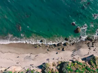
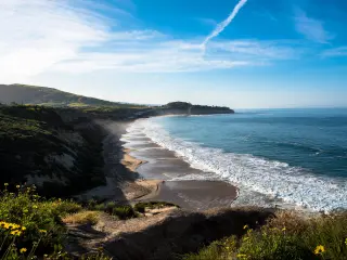
The Pacific Coast Highway is a legendary route along the stunning west coast and is one of the most Iconic road trips in the US, traveling along three-quarters of the California coastline with views of the glistening Pacific all the way. The route passes through towns and cities alongside beautiful golden beaches and is a glorious way to discover some of the best sights the Golden State has to offer.
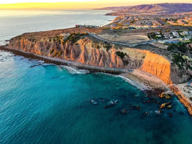
The Pacific Coast Highway starts in Leggett and covers 655 miles of breathtaking scenery, hugging the Pacific coastline all the way to Dana Point. The route passes some amazing places including San Francisco, Monterey, Big Sur, and Los Angeles.
Enjoy America's favorite and most scenic coastal drive taking in lush forests, classic walking trails, and marvel at the rugged cliffs and inviting golden beaches. Keep on reading to discover the many delights that await you on this awesome adventure.
Where is Pacific Coast Highway located and where does it start and end?
Pacific Coast Highway begins in Leggett, in Mendocino County, and ends at Dana Point, in Orange County, passing some amazing north Californian forest parks as it hugs the coastline down to San Francisco.
The route continues towards Half Moon Bay before passing Big Basin Redwoods State Park and heading around Monterey Bay.
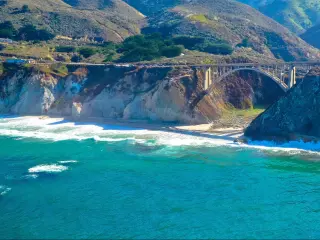
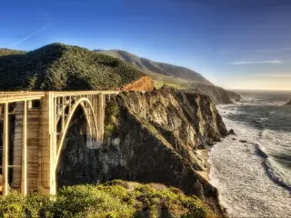
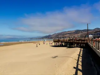
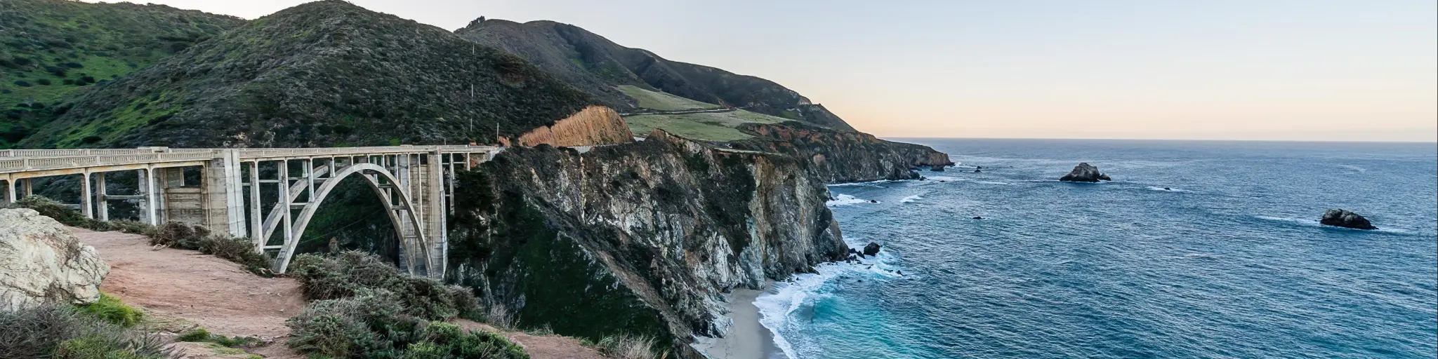
It then continues past Carmel-By-The-Sea and the mountainous region of Big Sur with its beautiful natural coastline, before heading onwards to Morro Bay and Santa Barbara before reaching Los Angeles.
Continuing to hug the coastline, the route passes Long Beach and Laguna Beach before arriving at Dana Point.
The starting point of Pacific Coast Highway
The Pacific Coast Highway begins at Legget in Mendocino County. Joining the CA-1 (State Route 1) at Leggett heading south is the best way to take on the Pacific Coast Highway.
Traveling north to south allows uninterrupted views out across the Pacific Ocean and ensures you are closer to the rugged cliffs that grace the route, and the amazing shoreline.
It also makes it easier to pull over for the many photo opportunities that will present themselves along the way, without having to cut across oncoming traffic.
The end point of Pacific Coast Highway
Dana Point in Orange County is recognized as the end of the Pacific Coast Highway. It's a city known for its relaxed surfing culture boasting some of the best beaches in southern California. It is renowned for being one of the best places in the world for spotting dolphins and whales.
With 6.5 miles of pristine beaches, the arrival at Dana Point is simply breathtaking as you head along the final stretch of the PCH, with Capistrano Beach considered the end of the route.
You can of course choose to make this the starting point of your journey, completing the route from south to north, and the trip will make many lasting memories whichever way you approach it.
Did Pacific Coast Highway change over time?
The original Pacific Coast Highway was the brainchild of a rural doctor in the 19th century who visited patients on horseback, with the initial road running from San Simeon to Carmel.
The road continued to grow over time and a coastal road was erected to connect Ventura and Santa Barbara, which by the early 20th century extended from Los Angeles to San Francisco.
The rugged coastal section around Big Sur was completed in the 1930s and the California Pacific Coast Highway as it is known today was officially opened in 1951.
Where can I start my Pacific Coast Highway trip?
Whilst the recognized start and end points of the route are Leggett and Dana Point respectively, you may wish to drive only part of the route, starting from an alternative destination, and with that in mind, you can use the table below to help you plan your alternative route.
| Origin city | Distance/Time (to Leggett) | Distance/Time (to Dana Point) |
|---|---|---|
| San Francisco | 220 miles/6 hours 10 minutes | 500 miles/11 hours 10 minutes |
| San Jose | 290 miles/8 hours 10 minutes | 470 miles/10 hours 20 minutes |
| Salinas | 340 miles/8 hours 40 minutes | 410 miles/9 hours |
| Paso Robles | 470 miles/12 hours 20 minutes | 270 miles/5 hours 35 minutes |
| Santa Maria | 500 miles/13 hours | 220 miles/4 hours 40 minutes |
| Santa Barbara | 570 miles/14 hours 15 minutes | 170 miles/3 hours 20 minutes |
| Los Angeles | 650 miles/16 hours | 90 miles/3 hours |
How long does it take to drive on Pacific Coast Highway?
Driving the full length of the 655-mile Pacific Coast Highway will heavily depend on traffic and can take anywhere between 12 and 16 hours.
If driving without making any stops or detours, you would miss out on so much by not stopping to embrace the wonderful activities and attractions that line the route and we recommend taking at least 3 days to drive this incredible route, and longer if time allows.
Traffic along the Pacific Coast Highway will vary depending on the time of year, and the time of day you are traveling. Around major cities, the roads will be more congested at rush hour, and although the summer months provide the best weather, the traffic will be at its heaviest as visitors flock to the west coast to enjoy its fantastic beaches.
Things to know that can impact your driving time
Here are our top tips for driving the Pacific Coast Highway in the shortest time possible:
- The section of the route around Big Sur narrows to one lane in parts making it a traffic hotspot. Slow driving and also stopping to admire the views and sneak a quick photo opportunity will create a hazard for other drivers and impatient drivers may attempt to overtake when it isn't always safe to do so.
- The route between Santa Barbara and Oxnard is renowned for being busy so take extra care on this section and allow extra time for any possible congestion you may encounter.
- If possible, it is advisable to make the trip outside of the summer holiday season and avoid weekends when the traffic will be at its busiest.
- With so many excellent viewpoints and beaches along the way, taking regular breaks will keep you refreshed and alert.
- Choose an SUV if possible as the higher driving position allows for better views. If you are making the trip in the summer, a convertible would be ideal, blasting the beach boys with the roof down as you feel the wind in your hair.
- Drive on weekdays if possible when there is likely to be less traffic and avoid rush-hour traffic around cities
- Always carry snacks and drinks in the car, and if traveling in summer take a cool bag to keep things nicely chilled.
Attractions and scenic areas on Pacific Coast Highway
The Pacific Coast Highway takes you through some picturesque coastal towns and some of California's major cities, with the chance to visit San Francisco and Los Angeles, and even San Diego if you choose to extend the final destination.
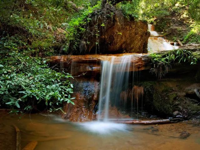
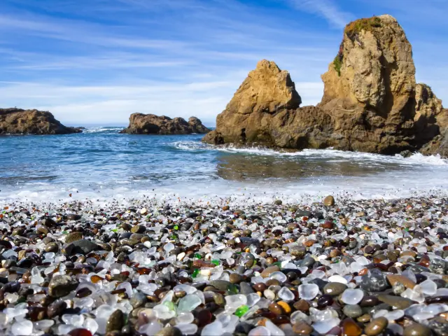
There are plenty of excellent natural wonders to explore as you make this amazing coastal journey with the chance to hike some amazing forest trails and capture on camera some of the many stunning views that you'll encounter along the way. Some of our favorites are:
- Garland Ranch Regional Park
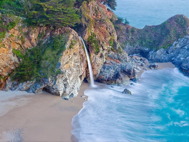
- McWay Cove Beach and McWay Falls
- Bixby Bridge Vista Point
- Pebble Beach 17-mile drive
- San Simeon
- Half Moon Bay
- Garrapata State Park and the Big Sur coastline
- Muir Woods National Monument
- Zuma Canyon Trailhead
- Escondido Canyon Park
- Morro Bay

Sasha Yanshin – Co-Founder & Lead Driver
Sasha Yanshin has spent the last 15+ years mapping and driving thousands of miles across Europe and the US. As the Co-Founder and Lead Driver of Lazytrips, he brings an analytical approach to road-tripping, sharing meticulously tested routes, realistic drive times, and the hard-earned logistical reality of the open road.
Read full bio