Is the Sea To Sky Highway Dangerous?
If you're looking for a drive that lets you explore the exhilarating mountain roads of British Columbia, then a trip on the Sea to Sky Highway could be just the route for you. Starting at sea level in downtown Vancouver, you'll head through the glorious Canadian wilderness and enjoy unrivaled mountain views as you head to the popular resort of Whistler, sitting at 2,200 feet.
The 120 km drive along the Sea to Sky Highway takes 1 hour and 30 minutes, and is certainly challenging, but isn't dangerous. This stunning mountain route winds its way past beautiful lakes, forests, fjords, and mountains and is truly awe-inspiring.
As well as the jaw-dropping scenery, the drive passes many provincial parks, with many opportunities to explore the great outdoors. Continue reading to learn about some of the challenges the route poses and how best to stay safe as you enjoy the many delights along the way.
Where is the Sea to Sky Highway located, and why might this drive be challenging?
The Sea to Sky Highway is an iconic drive in south British Columbia, Canada. The journey takes you from the harbor city of Vancouver to the breathtaking mountain setting of Whistler.
The Sea to Sky Highway, also known as British Columbia 99, is a great way to explore the beautiful alpine wilderness of western Canada.
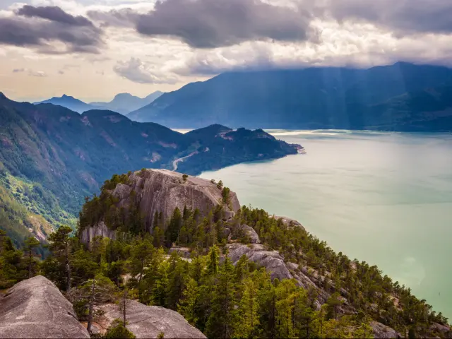
The route is famous for its scenic views, and along the way, you'll encounter crystalline lakes and snow-capped peaks, and amazing natural landscapes.
There are also fantastic places to stop and admire the incredible natural surroundings, take a ride on the Sea to Sky Gondola, and even make adrenaline-pumping bungee jumps.
British Columbia is prone to bad weather and conditions can change quickly, with snowfall, heavy rain, fog, and ice a common sight, especially in winter. The road surface can be slippery, and visibility is greatly reduced, making the drive more challenging.
As you'd expect driving in mountain regions, the terrain can be challenging, with steep inclines and narrow stretches, so always drive cautiously and beware of the conditions.
The route is popular amongst tourists and locals, and commuters and commercial vehicles can add to the congestion. As the locals are more familiar with the area and the road conditions, speeding can be an issue.
Driving the Sea to Sky Highway from Vancouver to Whistler
The Sea to Sky Highway is full of breathtaking scenery as it passes through the magnificent mountainous terrain, and the 120km route from Vancouver to Whistler takes around 1 hour and 30 minutes.
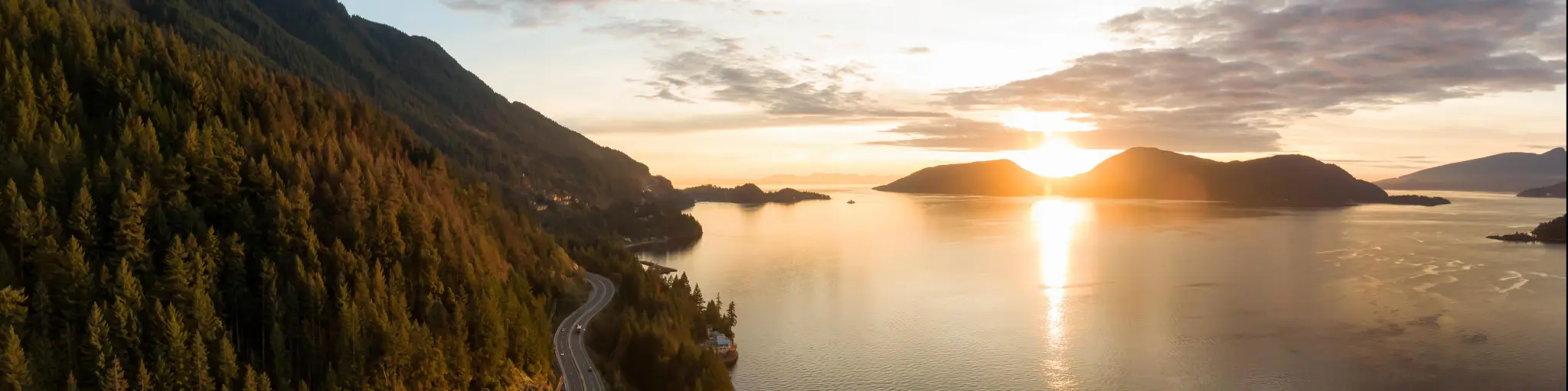
Leaving Vancouver, you'll hug the coastline, passing Horseshoe Bay and Charles Creek as you continue past Brunswick Mountain, with views over Howe Sound to Shannon Falls Provincial Park.
Here you can ride the Sea to Sky Gondola, savoring the views to the summit at 885 m. Once at the top, there are many trails to explore; you can enjoy a meal in the Sky Pilot Eatery and then cross the Sky Pilot Suspension Bridge if you dare.
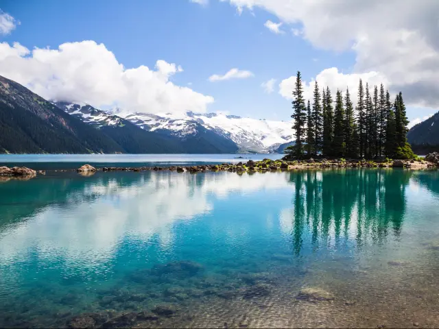
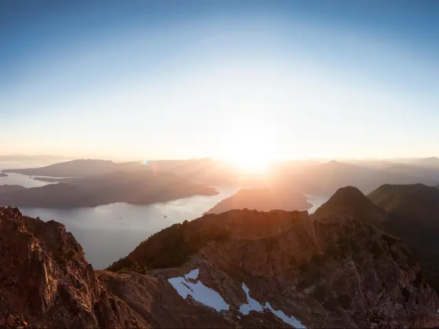
The route then continues past Squamish and the Alice Lake Provincial Park before arriving at the Tantalus Lookout, with its impressive panoramic vista of Brohm Lake and the Tantalus Mountain Range.
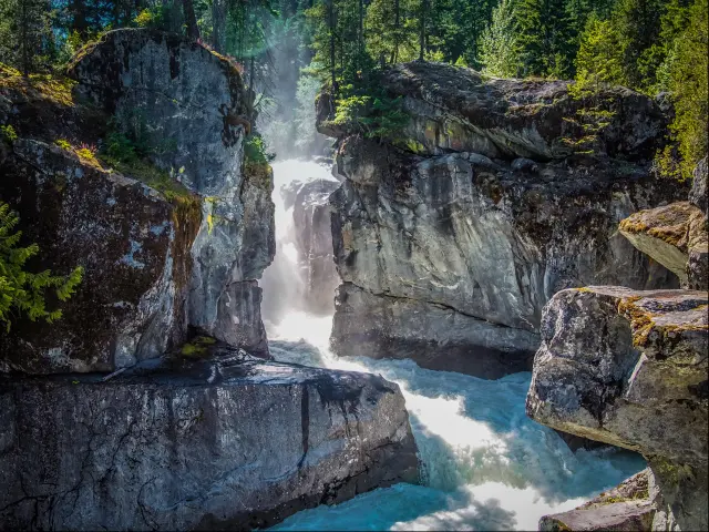
From here, the road continues past Cheakamus Canyon with views of Cloudburst Mountain before reaching Garibaldi. Continue past Daisy Lake, Brandywine Falls Provincial Park, and Tamarisk before the final ascent to Whistler.
Driving the entire length of BC-99
The Sea to Sky Highway only forms part of the entire British Columbia 99 route, known as Highway 99. You can extend the journey to complete the entire length of Highway 99, covering 325 km and taking around 4 hours and 40 minutes to complete.
Leaving Whistler, the route heads down through Alpine Meadows, and the road hugs the shores of Green Lake with stunning views of Rainbow Mountain before passing through Shadow Lake Interpretive Forest, with several loop trails to enjoy through the mighty Douglas-firs.
Continuing onwards, the road runs parallel to several rivers before arriving at Nairn Falls Provincial Park, where it's possible to spend a night under the stars camping, taking the opportunity of seeing the falls.
Leaving Nairn Falls, continue north to the town of Pemberton, a good place to stop for supplies and gas, before heading east past Lillooet Lake and Joffre Peak and skirting the southern shore of Duffey Lake before heading northwards, with mountains in every direction towards Lillooet.
Head left at the junction with the Lytton-Lillooet Highway, alongside the Fraser River, as it passes the Fountain Indian Reserve and continues onwards to Pavillion, and Pavillion Lake, before reaching the journey's end at historic Hat Creek Ranch.
Things to know that can impact the drive on the Sea to Sky Highway
The Sea to Sky Highway route is mostly two lanes in each direction, making overtaking possible and the journey less stressful. On some steep inclines, it increases to three lanes, allowing drivers to pass slower-moving vehicles to enjoy the route at your own pace.
The road has seen heavy investment over the years, primarily to cater to the Winter Olympics, and the road surfaces are excellent.
Speed limits along the route can vary, and for the most part, it is 90km per hour. This is lowered on some of the bends and exits where it can reach 50km per hour, and it is always worth remembering it is a limit, and driving slower in unfamiliar mountain regions is always sensible.
The road meanders through the mountains but isn't prone to dramatic switchbacks and doesn't reach a very high altitude, making it enjoyable for drivers of all abilities.
Tips to drive on the Sea to Sky Highway in the safest way
Driving the Sea to Sky Highway is a wonderfully scenic experience, but the remoteness and nature of the terrain can make the trip dangerous. Here are our top tips to ensure the journey is as safe and memorable as possible.
- Do fill up with gas before setting off if possible. There are gas stations in Vancouver and Whistler, and a couple around halfway, at Squamish Valley and at Garibaldi Highlands.
- Do pay attention to the road ahead at all times. The captivating scenery is sensational and can be distracting, but allowing your eyes to wander increases the chances of accidents and danger on the road.
- Do check road conditions before making the trip; you don't want road closures or adverse weather conditions to spoil the experience. For up-to-date travel information, check the Drive BC website.
- Do allow extra time on your journey to stop and take in the views, and always pull over when taking a photograph, rather than attempting to do so while driving.
- The route passes through stunning mountain scenery and wilderness, so it is essential you take essentials such as water, snacks, and a map of the area in case there is no cell phone coverage at a certain point.
- The area has an abundance of wildlife, including deer and bears, which may wander onto the highway, so always keep an eye out and slow down if there are animals in or near the road.
- Winter tires are recommended when driving the Sea to Sky Highway in winter, and you should always carry snow chains. At certain times of the year, the MOTI requires snow chains to be fitted, and failing to do so will result in a fine or a more severe penalty.
Alternatives to driving yourself on the Sea to Sky Highway
Driving the Sea to Sky Highway is the most popular way to travel along this fabulous route, but there are several alternative options available that mean you don't have to get behind the wheel yourself.
There are shuttle bus services operating between downtown Vancouver and Whistler, with the Whistler Shuttle running once or twice daily depending on the time of year, with the journey taking two hours.
The YVR Skylynx Shuttle has more frequent services in summer, running 5 times a day, and the Epic Rides Shuttle also has a more frequent service.
Another option is to engage in an epic cycling adventure along the Sea to Sky route, as the highway has dedicated cycling lanes in operation for most of the route, offering a much more challenging alternative.
It is also possible to tackle the stunning Sea to Sky region on foot, exploring the amazing natural wilderness along the numerous trails, exploring the scenic parks that line the route.
Best time to drive on the Sea to Sky Highway
While driving on the Sea to Sky Highway is always an exhilarating journey, traveling at certain times of day, and particular times of the year, can make the trip even more enjoyable.
If you want to enjoy the hiking trails along the way, making the trip between June and September is the best time to do so because a lot of the snow has melted, and you can enjoy the outdoors in more enjoyable weather. The longer days will also give you more time to explore the great outdoors.
However, summer is also the peak tourist season, so it will be busier, and the traffic will increase, especially during the holidays and weekends.
Traveling the Highway in Spring and Fall is picturesque as the wildflowers bloom around March, and the leaves change color in fall, providing a wonderful backdrop.
The area is transformed in winter, with Whistler renowned as a skiing hotspot, and the area becomes a winter wonderland and is the place to go for winter sports enthusiasts. Naturally, the road conditions will be potentially dangerous, and driving in the mountains is very challenging in winter.

Sasha Yanshin – Founder & Lead Driver
Sasha Yanshin has spent the last 15+ years mapping and driving thousands of miles across Europe and the US. As the Founder and Lead Driver of Lazytrips, he brings an analytical approach to road-tripping, sharing meticulously tested routes, realistic drive times, and the hard-earned logistical reality of the open road.
Read full bio