THE 22 BEST Road Trips from Phoenix

Phoenix is surrounded by some of the most dramatic landscapes in America. The Grand Canyon is 4 hours north, Sedona is 2 hours up I-17, the California coast is a day's drive west, and the Utah national parks are a day north through the Navajo Nation.
I've driven from Phoenix to the California coast, been up through the Rockies, and across the US-93 to Vegas - this guide is everything I've learned about which routes to take and what to watch out for.
Read this before driving out of Phoenix
🗺️ Driving Through the Navajo Nation
Routes north to Monument Valley, Moab, and Page cross the Navajo Nation - gas stations can be 50+ miles apart and cell service drops out for long stretches. Arizona doesn't observe daylight saving time but the Navajo Nation does, so your clock shifts an hour at the border. Fill up whenever you can and download your maps offline before you leave.
🚗 The I-17 Friday Crush
Every road trip north - Sedona, Flagstaff, Grand Canyon - starts on I-17. On Friday afternoons, half of Phoenix tries to escape the heat at the same time. The two-lane stretch between Black Canyon City and Camp Verde becomes a parking lot. Leave before noon or after 7pm, or your 2-hour drive to Sedona becomes 4.
🏔️ The Elevation Swing
Phoenix sits at 1,100 feet. Flagstaff is at 7,000 and the Grand Canyon rim is over 7,000. You can leave Phoenix in 110°F heat and arrive somewhere that drops below freezing at night - on the same day. Pack layers even in summer, and don't assume desert means hot everywhere.
Top Road Trip Destinations From Phoenix
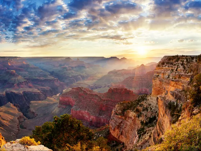
🚗 230 miles ⏱️ 3 hours, 40 minutes
The Grand Canyon is less than 4 hours north of Phoenix - straight up I-17 to Flagstaff, then Highway 64 west to the South Rim. Plan for extra time on the return via the Eastern Entrance - there are many amazing overlooks and places to stop along Desert View Drive.
💡 Beat the Vegas Crowds: Phoenix is a full hour closer to the Grand Canyon than Las Vegas, and most of the big tour buses come from Vegas. Leave Phoenix early in the morning and you can have the rim viewpoints mostly to yourself before the tour groups start arriving mid-morning.
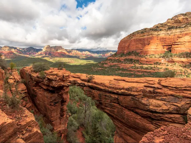
🚗 120 miles ⏱️ 2 hours
Sedona is only 2 hours north on I-17 and it's the easiest weekend trip from Phoenix. The red rock formations are the draw - Cathedral Rock, Bell Rock, and Devil's Bridge are all short hikes with views that more than justify the drive.
💡 The Trailhead Parking Trap: Popular trailheads like Cathedral Rock and Soldier Pass close their parking lots Thursday through Sunday, and the others fill up early. Use the free Sedona Shuttle park-and-ride lots instead - they drop you right at the start of the major trails.
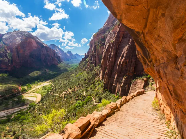
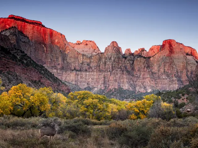
🚗 400 miles ⏱️ 6 hours, 30 minutes
Zion's canyon walls rise 2,000 feet on both sides and you can hike through the river at the bottom. Bryce Canyon is 90 minutes further east - thousands of red rock spires you can walk down into. The two parks combine naturally into one trip.
💡 Angels Landing Permits: The most famous hike in Zion requires a permit - enter the lottery 2-5 months ahead. If you don't get one, there's a day-before lottery each day you're in the park.
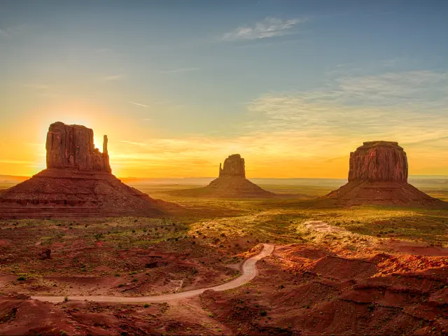
🚗 320 miles ⏱️ 5 hours
Monument Valley is an easy drive north through Flagstaff and Tuba City. As you pass Tuba City in the Navajo Nation, the landscape opens up and the red sandstone starts appearing on the horizon. The buttes themselves are much bigger and further apart than photos suggest - the valley floor covers nearly 92,000 acres.
💡 Book a Navajo-Guided Tour: The 17-mile Valley Drive loop is an unpaved dirt road that you're allowed to drive in your own car, but it only covers a small section of the valley. Navajo-guided tours go into restricted areas that are off-limits to self-drive visitors, including spots like Ear of the Wind and the narrow canyon arches.
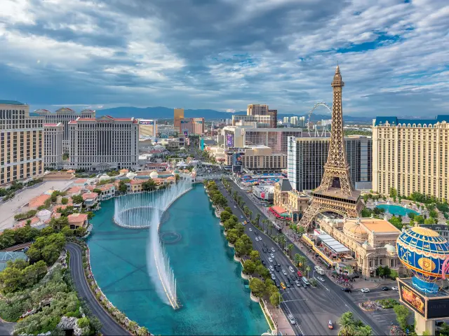
🚗 300 miles ⏱️ 5 hours
Vegas is about 5 hours northwest on US-93. The drive is very straight-forward, although a bit boring through empty desert, but arriving with your own car is an advantage - Red Rock Canyon, Valley of Fire, and Death Valley are all easy day trips you can take before hitting the town in the evening.
🚙 Stop at Nothing Most people drive straight through a place called Nothing, Arizona, but this is probably the favorite photo I've ever taken in the United States. A giant retro sign saying "Nothing" above you and your car with a desert backdrop is worth a stop.
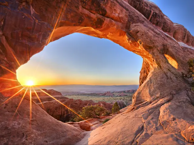
🚗 470 miles ⏱️ 7 hours, 30 minutes
Moab is the basecamp for Arches and Canyonlands National Parks - two parks, plus the Colorado River, mountain biking, and off-road trails all within 30 minutes of town. The drive north from Phoenix crosses the Navajo Nation and the landscape shifts from desert scrub to red rock canyon country.
💡 Arrive Early for Arches: Arches dropped its timed-entry system for 2026 but the park still fills up fast. Gates can close as early as 9am on busy days and the best trailhead parking goes before that. Plan to be at the entrance before 8am or you risk being turned away.
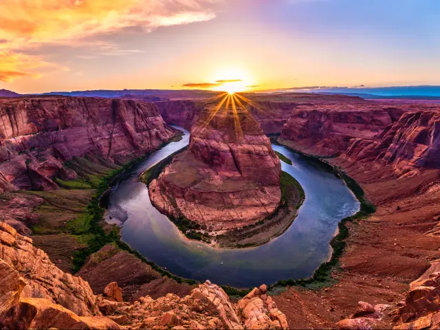
7. Page & Lake Powell
🚗 275 miles ⏱️ 4 hours, 30 minutes
Page is about 4.5 hours north of Phoenix via Flagstaff and it packs more into a small area than almost anywhere in Arizona. Horseshoe Bend is a short walk from the parking lot - the Colorado River does a 180-degree turn 1,000 feet below you in a near-perfect horseshoe. Antelope Canyon's slot canyons are minutes away, and Lake Powell stretches out behind the dam with hundreds of miles of shoreline.
💡 Book Antelope Canyon Early: You can't visit Antelope Canyon without a guided tour as it's on Navajo land and independent access isn't allowed. Tours sell out weeks ahead in peak season, especially for Upper Antelope Canyon. Book as early as you can and don't assume you'll get a walk-up slot.
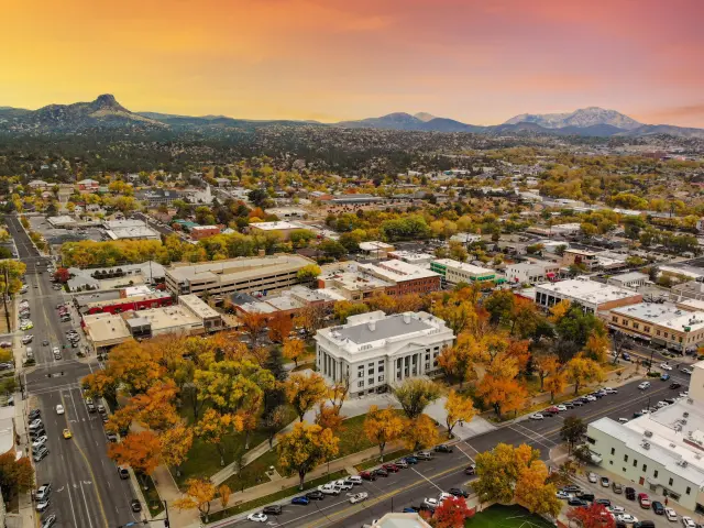
8. Prescott & Jerome
🚗 100 miles ⏱️ 1 hour, 40 minutes
Prescott and Jerome sit an hour apart in the mountains above the desert, and together they make the easiest weekender in central Arizona. Prescott has Whiskey Row - a block of Old West saloons still going since the 1800s - and the granite boulders and lake at the Dells just outside town. Jerome clings to the side of Cleopatra Hill, a copper-mining boomtown that nearly became a ghost town and reinvented itself as an artist's haunt, with switchback streets and valley views the whole way up.
🌡️ The Summer Escape: Prescott sits at 5,400 feet and runs 20-30 degrees cooler than Phoenix, which is exactly why half the city drives up on a summer weekend. Book a room ahead from June to August - the small downtown hotels fill fast, and turning up without a reservation on a hot Saturday is how you end up driving home the same night.

🚗 355 miles ⏱️ 6 hours, 30 minutes
San Diego is about 6 hours west on I-8 through three distinct desert environments. Just before the California border, the Imperial Sand Dunes appear out of nowhere - I didn't expect to see towering Sahara-style sand dunes on this route.
💡 Stay in the Gaslamp Quarter: You have a choice of staying where it's all happening or near the beaches. I'd say being able to go to dinner and have a drink in the evening is more important than needing to drive 20 minutes to a beach in the morning.
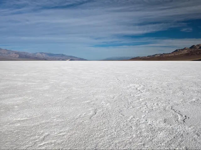
🚗 415 miles ⏱️ 7 hours
The name is not an exaggeration - this is the hottest desert in the world. Badwater Basin is a vast white salt flat sitting 282 feet below sea level, Zabriskie Point is your desktop background from 1998, and the Mesquite Flat Sand Dunes stretch to the horizon in every direction.
🚨 Avoid in Summer: This is not a bring extra water situation. Ground temperatures exceed 130°F from June through September and people die here every year from heat exposure. Hiking is only feasible at sunrise and it's still way too hot when the sun is setting. If your aircon is good, it might be fun to drive through, but you won't want to get out of the car, so it's not worth the 7-hour drive.
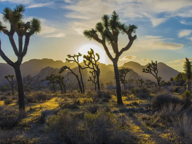
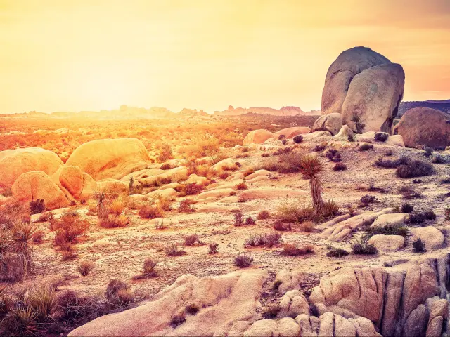
🚗 230 miles ⏱️ 3 hours, 30 minutes
The twisted spiky Joshua trees look like they belong on another planet. The park also has massive boulder formations, some of the best rock climbing in the US, and Gold Tier dark sky certification for stargazing. It spans two desert ecosystems - sparser and hotter in the south, denser and more dramatic in the north where the Joshua trees actually grow.
💡 Enter From the South: The south entrance off I-10 is the fastest way in from Phoenix even though most of the sights are in the north half of the park. There's not a lot to see until you reach the Cholla Cactus Garden (30 minutes from the Cottonwood Visitor Center) and the Joshua trees appear as you reach the Arch Rock Trail 15 minutes later.
12. Rocky Point, Mexico
🚗 215 miles ⏱️ 3 hours, 40 minutes
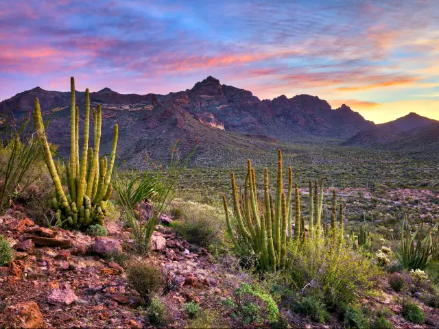
The closest beach to Phoenix is not San Diego - it's Rocky Point (Puerto Peñasco) on Mexico's Sea of Cortez. The water here is warm, the beaches are wide and sandy, and a weekend trip costs a fraction of a California equivalent. The drive south through Organ Pipe Cactus National Monument is worth the trip on its own - one of the most underrated national monuments in Arizona.
💡 Get Mexican Car Insurance: Your US auto insurance does not cover you in Mexico. Buy a Mexican car insurance policy before you cross - you can get them online in minutes from providers like Baja Bound or Lewis & Lewis, and they're cheap for a weekend. You'll also need a valid passport or passport card at the Lukeville/Sonoyta border crossing. The crossing itself is quick and straightforward.
🚗 375 miles ⏱️ 5 hours
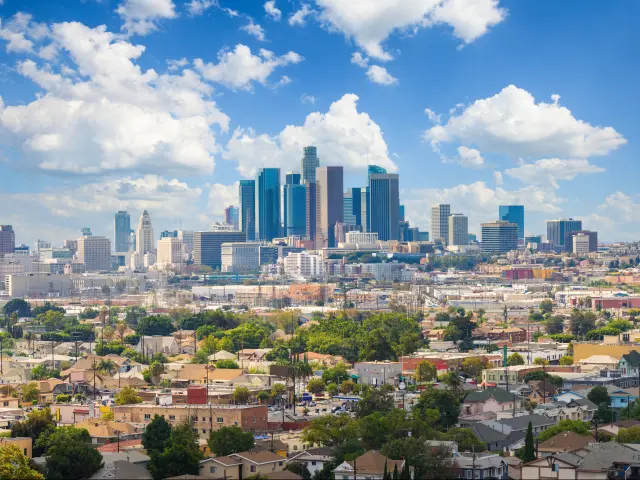
LA is huge - dozens of distinct neighborhoods spread across a massive area. Santa Monica, Venice Beach, Hollywood, Downtown, and Silver Lake are all completely different vibes and can be 30-60 minutes apart depending on traffic. The drive from Phoenix could not be simpler - 6 hours on the I-10 in a straight line.
💡 Avoid Rush Hour: LA freeway traffic turns into the world's largest car park at rush hour and Friday afternoon is the worst - the I-10 backs up from the eastern suburbs right through downtown and what should be a 20-minute drive across town turns into 90 minutes. Leave Phoenix in the morning and save yourself an hour.
14. Flagstaff
🚗 145 miles ⏱️ 2 hours, 15 minutes
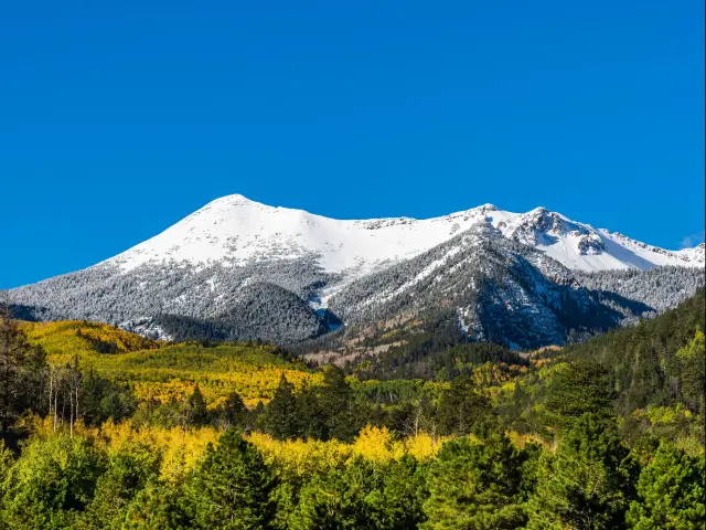
Flagstaff is 2 hours north and 6,000 feet up - the closest thing to an escape from Phoenix heat without leaving the state. The historic downtown runs along old Route 66 with good restaurants and breweries. In winter, Arizona Snowbowl is the closest skiing to Phoenix. In summer, it's a base for hiking among ponderosa pines instead of cacti.
💡 It Snows Here: Flagstaff gets more annual snowfall than most cities in Colorado. If you're driving up from Phoenix in winter, you can leave in 70°F sunshine and hit a blizzard 90 minutes later. Check I-17 conditions before you leave and carry chains if there's any forecast of snow.

🚗 480 miles ⏱️ 7 hours, 30 minutes
Santa Fe sits at 7,000 feet in the mountains at the end of a long drive across the New Mexico high desert. The whole city is built in adobe style - even the McDonald's. The main reason to come is the food - you have to join the local debate on red chile vs green chile but "no chile" is not an option.
Albuquerque is on the way and worth a stop, especially for the Sandia Peak Tramway at sunset.
🎈 Balloon Fiesta: The Albuquerque International Balloon Fiesta runs for 9 days in early October - 500+ balloons launching at dawn which looks epic. It's amazing to see, but if you're not coming for the balloons, try and avoid the dates as hotels run double the price and sell out.
16. White Sands National Park
🚗 450 miles ⏱️ 6 hours, 30 minutes
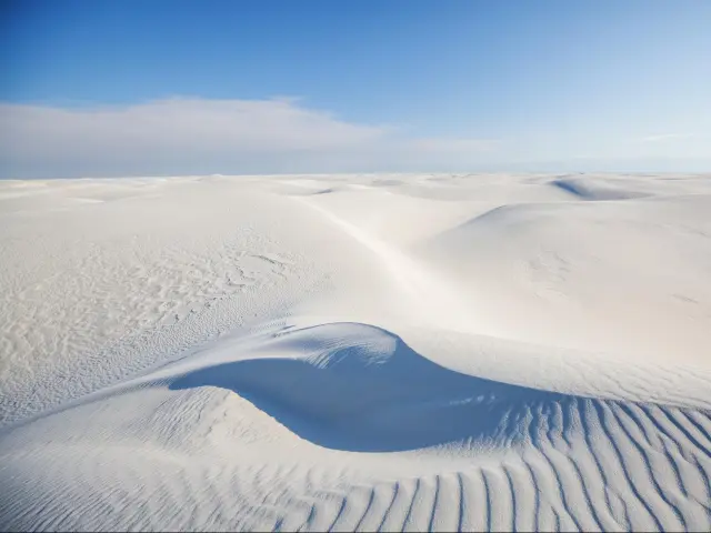
White Sands is a vast 275 square miles of pure white gypsum dunes stretching to the horizon. Gypsum reflects sunlight and retains water, so it keeps a lot cooler than sand even when the air is hot. You can sled down them on a plastic disc, and the dunes glow at sunset just before the park closes. Las Cruces is 45 minutes away and it's the obvious place to stay over.
🌅 Beat the Midday Heat: Midday at White Sands in the summer is brutal - there's no shade, and heat bounces straight back up at you from the gypsum. So there's no benefit to setting off at the crack of dawn - take time with your breakfast and aim to get there later in the afternoon when temperatures drop or spend the evening in Las Cruces and head to the park first thing in the morning.
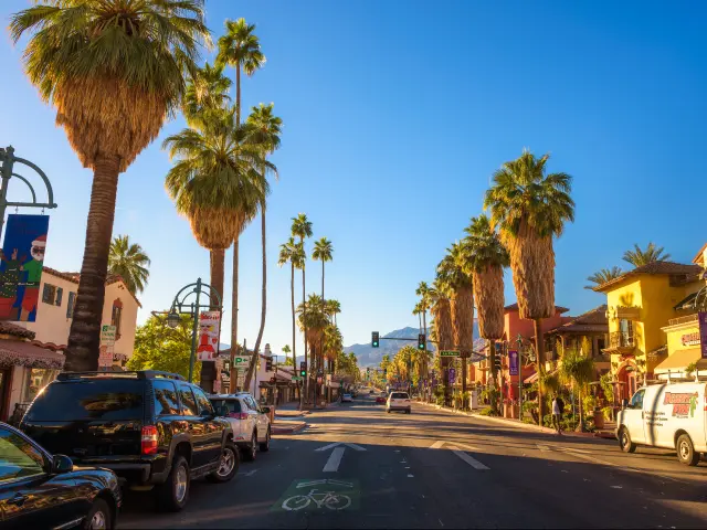
🚗 265 miles ⏱️ 4 hours, 20 minutes
The mid-century modern architecture is everywhere - entire neighborhoods of flat-roofed, glass-walled houses from the 1950s and 60s that look like they're straight out of a design magazine. The Palm Springs Aerial Tramway takes you from the desert floor to the top of Mount San Jacinto at 8,500 feet in ten minutes - the temperature drops 30-40 degrees between the bottom and the top.
📅 It's a Winter Destination: Palm Springs empties out in summer when temperatures hit 110-120°F and most people avoid the desert entirely. But that means hotel prices drop by half or more. If you don't mind the heat and plan to spend most of your time at the pool, summer is a bargain. Peak season is November through March when snowbirds arrive and prices go up accordingly.
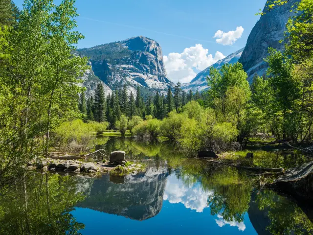
🚗 680 miles ⏱️ 11 hours
One of the most iconic views of any US National Park is the Tunnel View as you drive into Yosemite Valley - El Capitan, Bridalveil Fall, and Half Dome leave a narrow valley ahead as the Merced River snakes its way down next to the road.
The fastest way to Yosemite is to follow I-10 to LA, I-5 & Highway 99 to Fresno before taking Highway 41 up to the park entrance and the Mariposa Grove just after you enter - a forest of giant sequoias. In the summer, the alternative route over Tioga Pass takes about 30 minutes longer, but the scenery beats the interstate as you pass Mono Lake and cross Tuolumne Meadows on the way over the Sierra Nevada.
💡 No Reservation in 2026: Yosemite has flip-flopped on entry reservations almost every year. For 2026 there's none required, which has unfortunately brought back the gridlock. Get there before the lots fill mid-morning, or after 2pm when day-trippers clear out. Your best bet is to leave the car and use the free valley shuttle to get around.
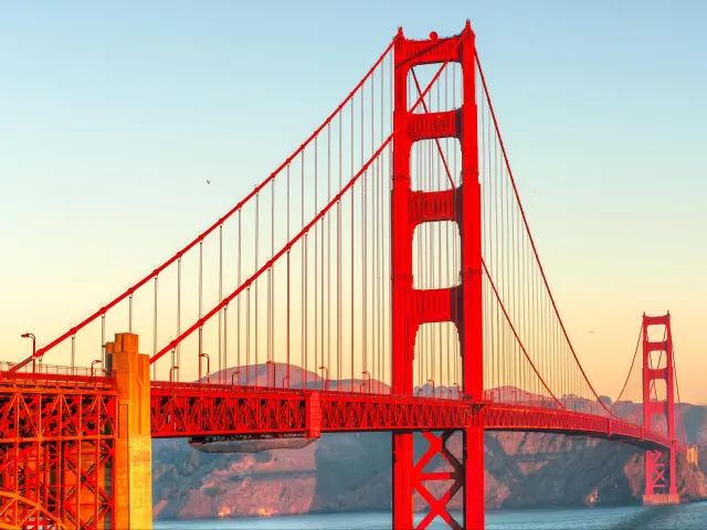
🚗 750 miles ⏱️ 11 hours
Everyone pictures the Golden Gate Bridge, but coming from the east you roll into San Francisco over the Bay Bridge or through Silicon Valley instead - the downtown towers rising ahead in the distance.
There's only one obvious route via I-10 west toward Los Angeles, then I-5 north up the long, flat Central Valley - it's fast but famously dull. Alternatives via the coast up from LA or over the Sierra Nevada via Tioga Pass in summer are prettier, but add 3 hours of driving (and probably an extra overnight stop if you actually want to see the scenery).
🧥 Pack a Jacket: San Francisco's summer is its cold season - fog pours in off the Pacific through July and August, and with the wind off the water, highs often sit in the low 60s. Driving in from a 110°F Phoenix summer, the chill catches a lot of people off guard, so bring layers whatever the date.
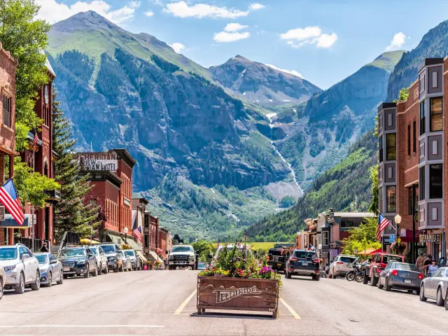
🚗 485 miles ⏱️ 7 hours, 50 minutes
Telluride sits in a box canyon with 13,000-foot peaks on three sides and a waterfall visible from the main street. It's a long drive from Phoenix but the last stretch through the San Juan Mountains is some of the most dramatic mountain scenery in America. In winter it's a world-class ski resort. In summer the town hosts its film festival and the hiking season is on.
💡 Skip the Parking Hunt: Telluride is a dead-end valley with almost no public parking. Don't bother circling the streets - drive to the free lot in Mountain Village and ride the free gondola down into town. It takes 13 minutes and drops you straight onto Main Street.
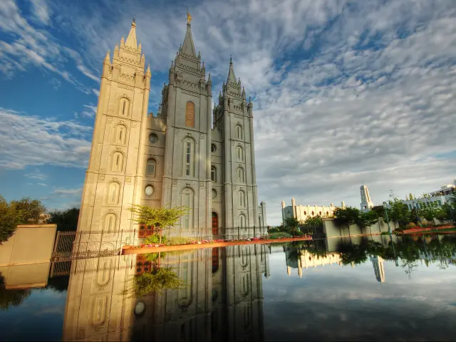
🚗 660 miles ⏱️ 10 hours
The Wasatch Range stands tall along the eastern edge of downtown, rising straight off the valley floor to 11,000-foot peaks barely a few miles from the city center.
There are 3 very different ways to get to Salt Lake City - you can go via Las Vegas and Zion National Park, via Page or through Moab. There's less than an hour's difference between them, so I'd highly recommend going up and coming back down via different routes to see vastly different places along the way, even if you don't have time to stop.
⛷️ Beat the Ski Traffic: Four world-class resorts sit in the canyons within forty minutes of downtown, and on a big snow day the road up Little Cottonwood to Alta and Snowbird backs up for hours. Stay over in Salt Lake City and get up early to beat the traffic.
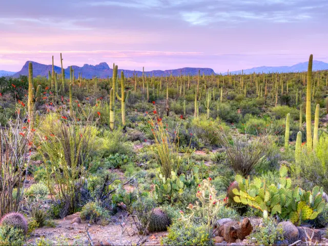
🚗 115 miles ⏱️ 1 hour, 50 minutes
Tucson is the shortest drive on this list and worth it for Saguaro National Park alone. There's thousands of giant saguaro cacti covering the hillsides in every direction. The park has two separate districts on either side of the city: the western Tucson Mountain District has the densest forest and a scenic loop drive, while the eastern Rincon Mountain District has longer hiking trails into the mountains.
💡 Stay Overnight: Tucson is one of the best cities in the US for food, especially seriously good Mexican - it's a UNESCO City of Gastronomy for a reason. So if you want to do it justice, stay over and enjoy the food in the evening. You also benefit from being able to get on the hiking trails at first light before the heat sets in.
If you want something bigger, check out my guide to cross-country road trips from Phoenix - including routes to Austin, Dallas, Yellowstone, and Seattle.

Sasha Yanshin – Founder & Lead Driver
Sasha Yanshin has spent the last 15+ years mapping and driving thousands of miles across Europe and the US. As the Founder and Lead Driver of Lazytrips, he brings an analytical approach to road-tripping, sharing meticulously tested routes, realistic drive times, and the hard-earned logistical reality of the open road.
Read full bio